Picos De Europa
Day One - Fuente De & Collado de Valdominguero – A Weekend Summit Camp
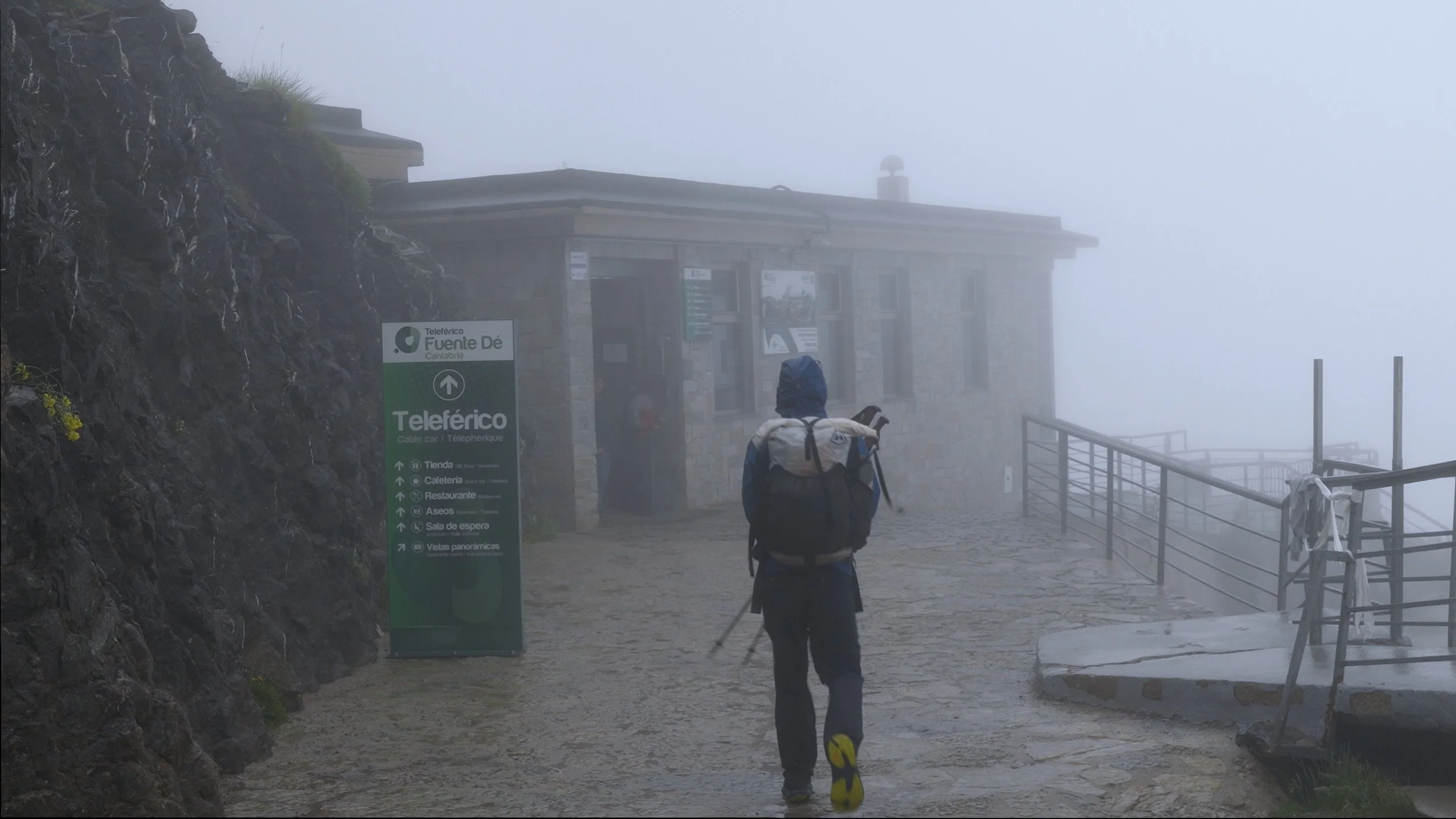
Starting point: Fuente De cable car
Campsite: 43°11'59.77"N 4°44'13.75"W
Distance: 9.5 miles
Elevation gain: ~3000 feet
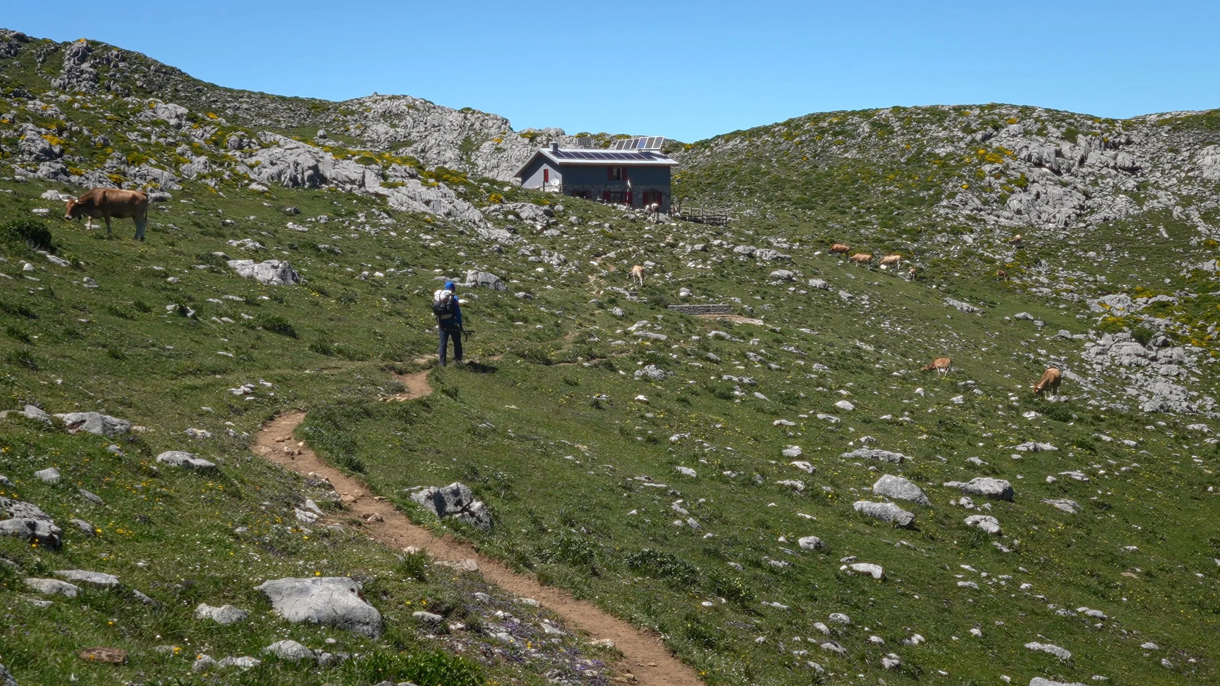
I started the day driving to Fuente De, parking at the cable car lot. In hindsight, coming on a weekend was a mistake — the queue for the cable car was long, and the wait ate into precious morning time. The cable car doesn't run until 10am, which is a real drawback in summer when the sun is already blazing by mid-morning. Worth noting for future trips: there's a trail leading up from the parking lot if you want to bypass the cable car entirely and get an earlier start.
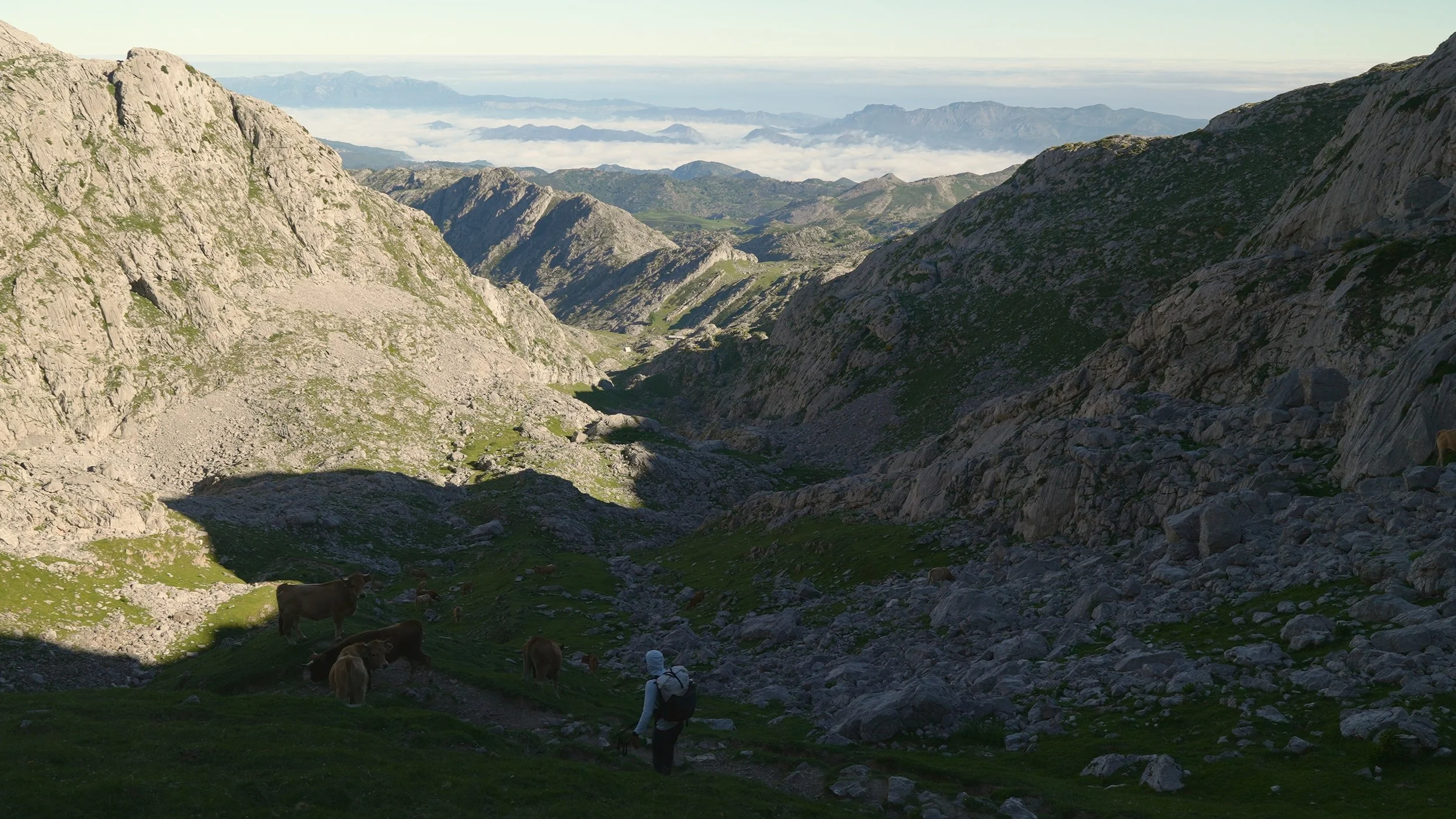
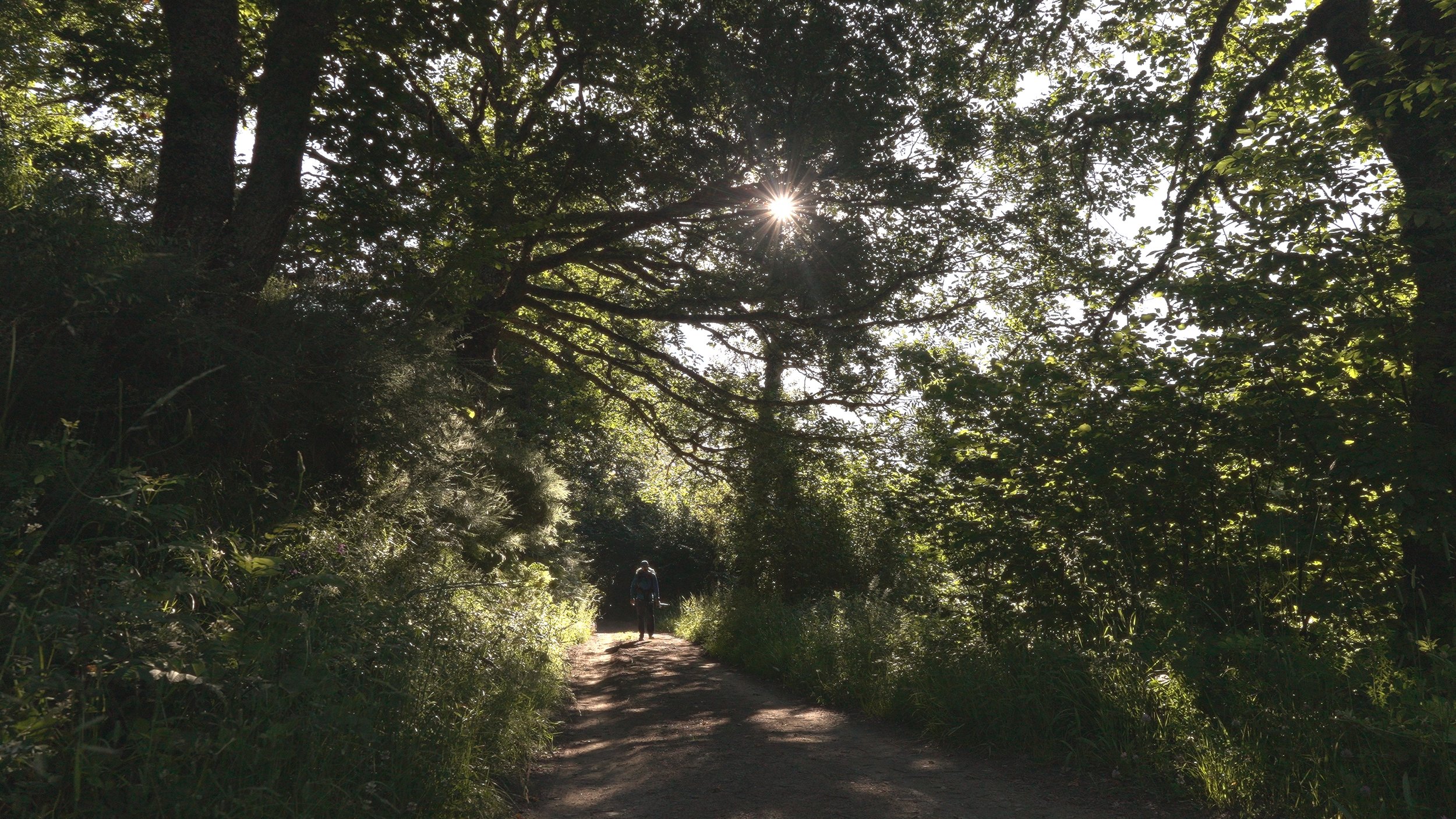
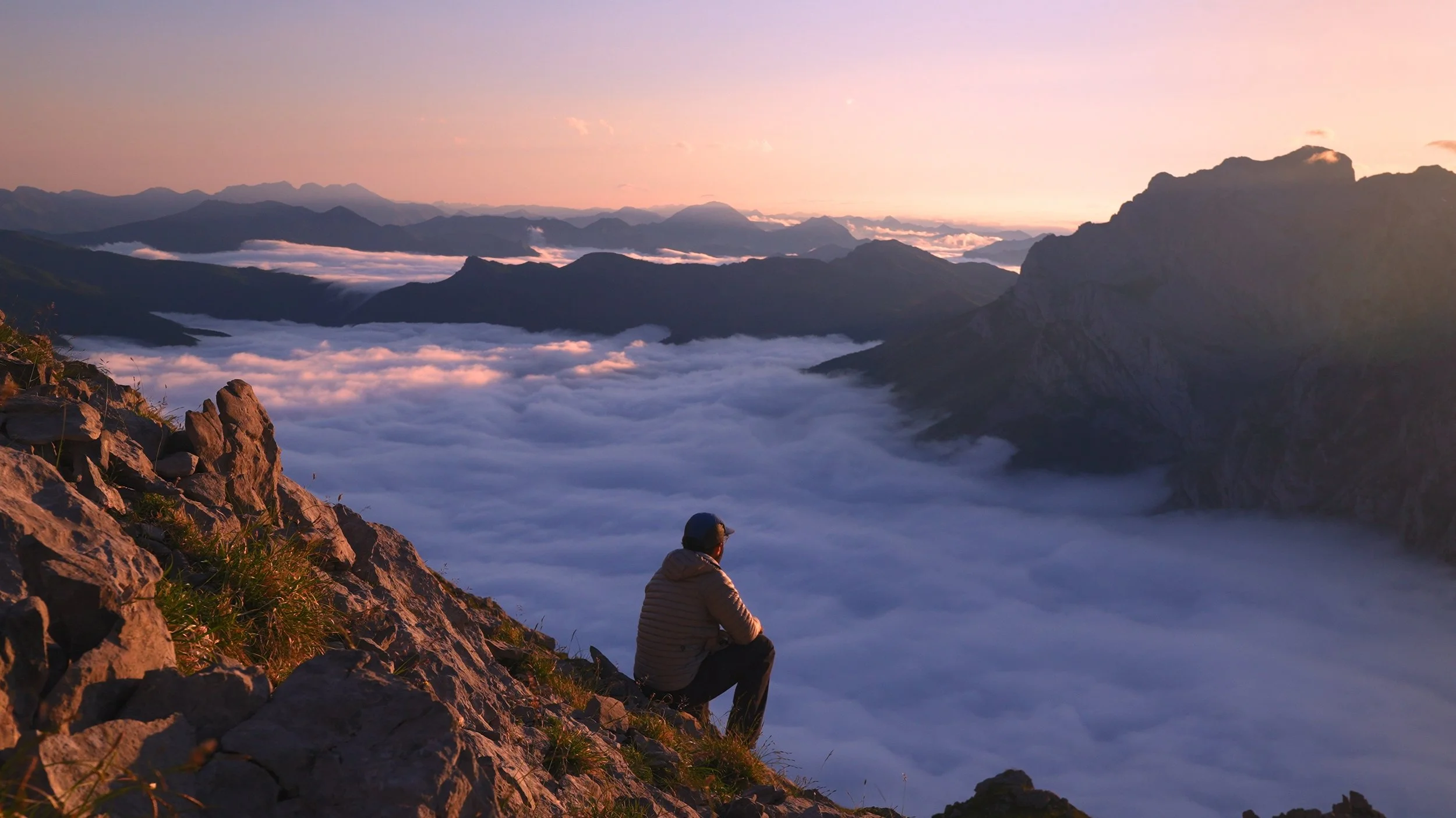
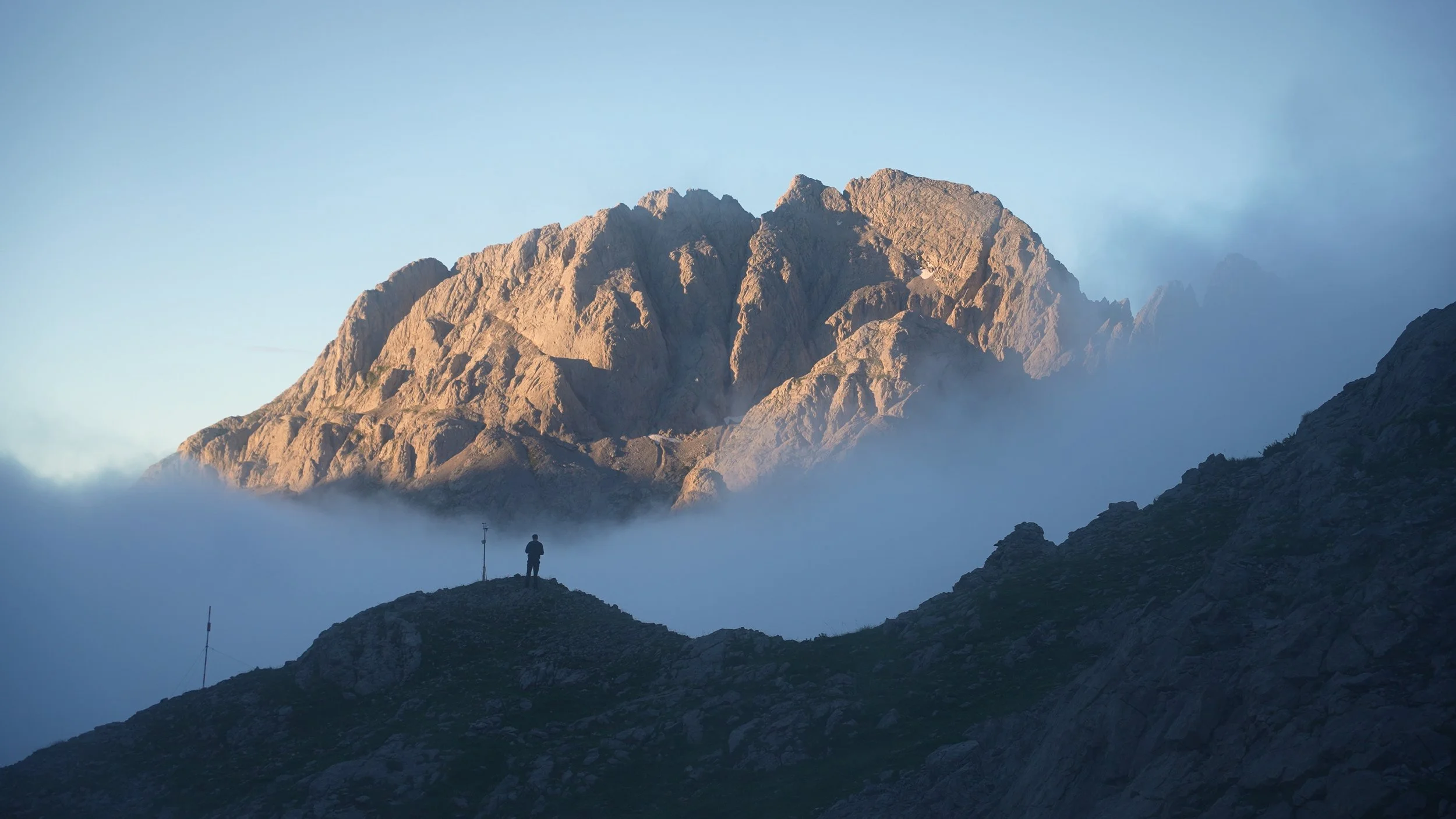
Stepping off at the top, the path was busy at first but mercifully flat. Cow bells rang out across the hillside — a constant, almost meditative soundtrack — and the cows themselves appeared and disappeared through low-hanging clouds and ribbons of fog that lent the landscape a wonderfully dramatic quality.
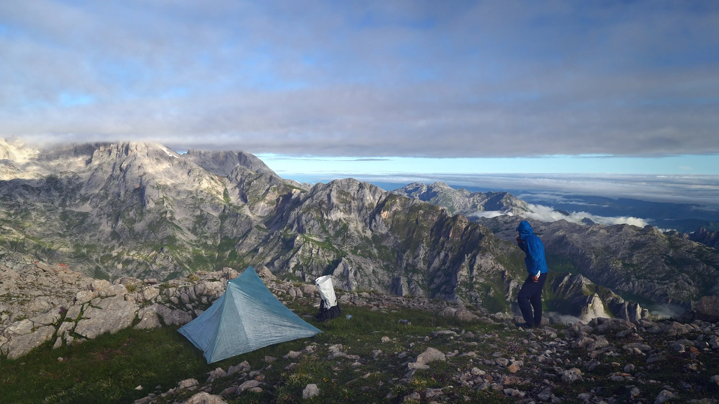
After a few miles, I peeled right toward Collado de Valdominguero. The trail steepened steadily, and route-finding became a genuine challenge — I lost the path more than once and found myself relying on AllTrails just to get back on track, only to drift off it again shortly after. The upper section turned into a serious scramble: loose scree, hands and knees, the works. Just before the summit, the trail funnels into a narrow canyon where a fixed rope guides you through the final few meters. This is not the place to be distracted by a perfect shot — focus, move carefully, and save the camera for the top.
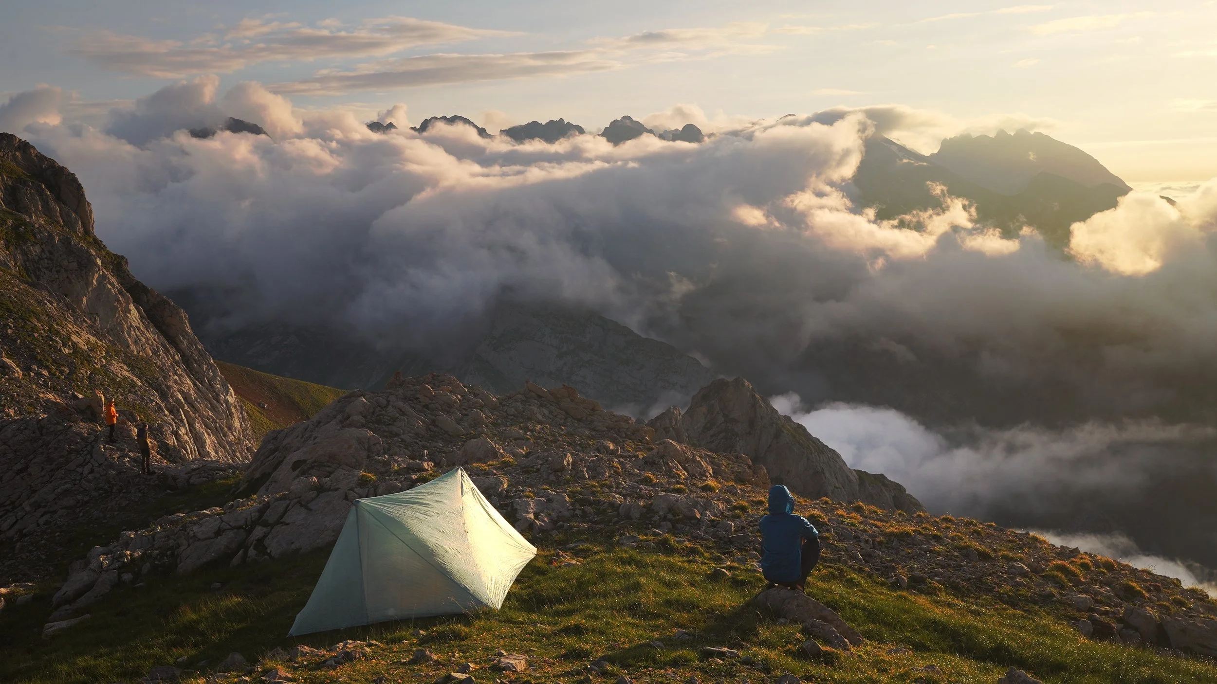
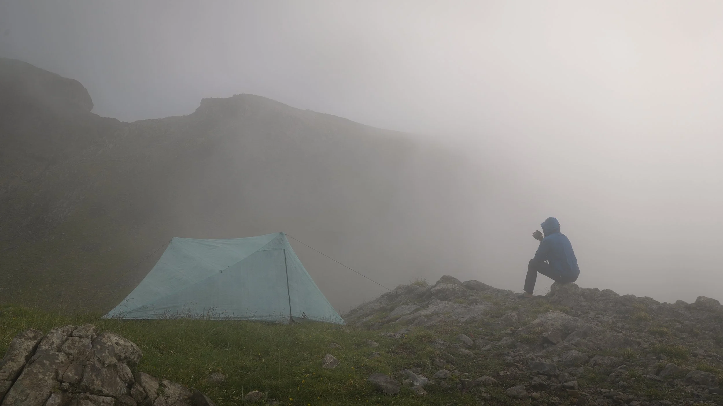
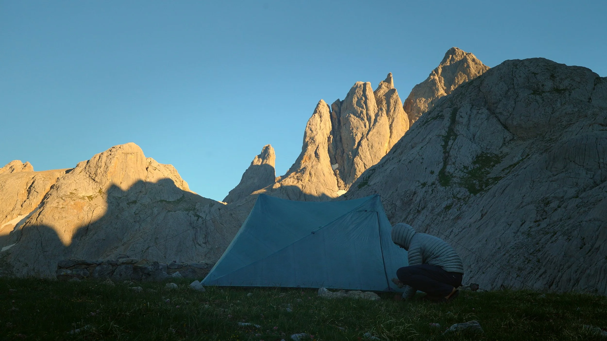
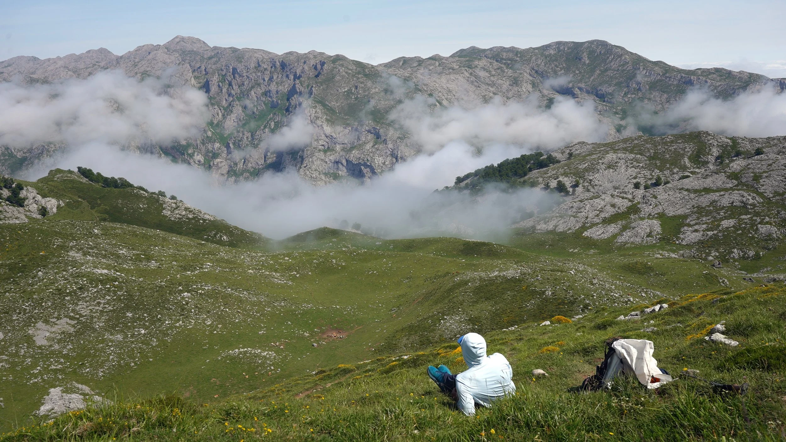
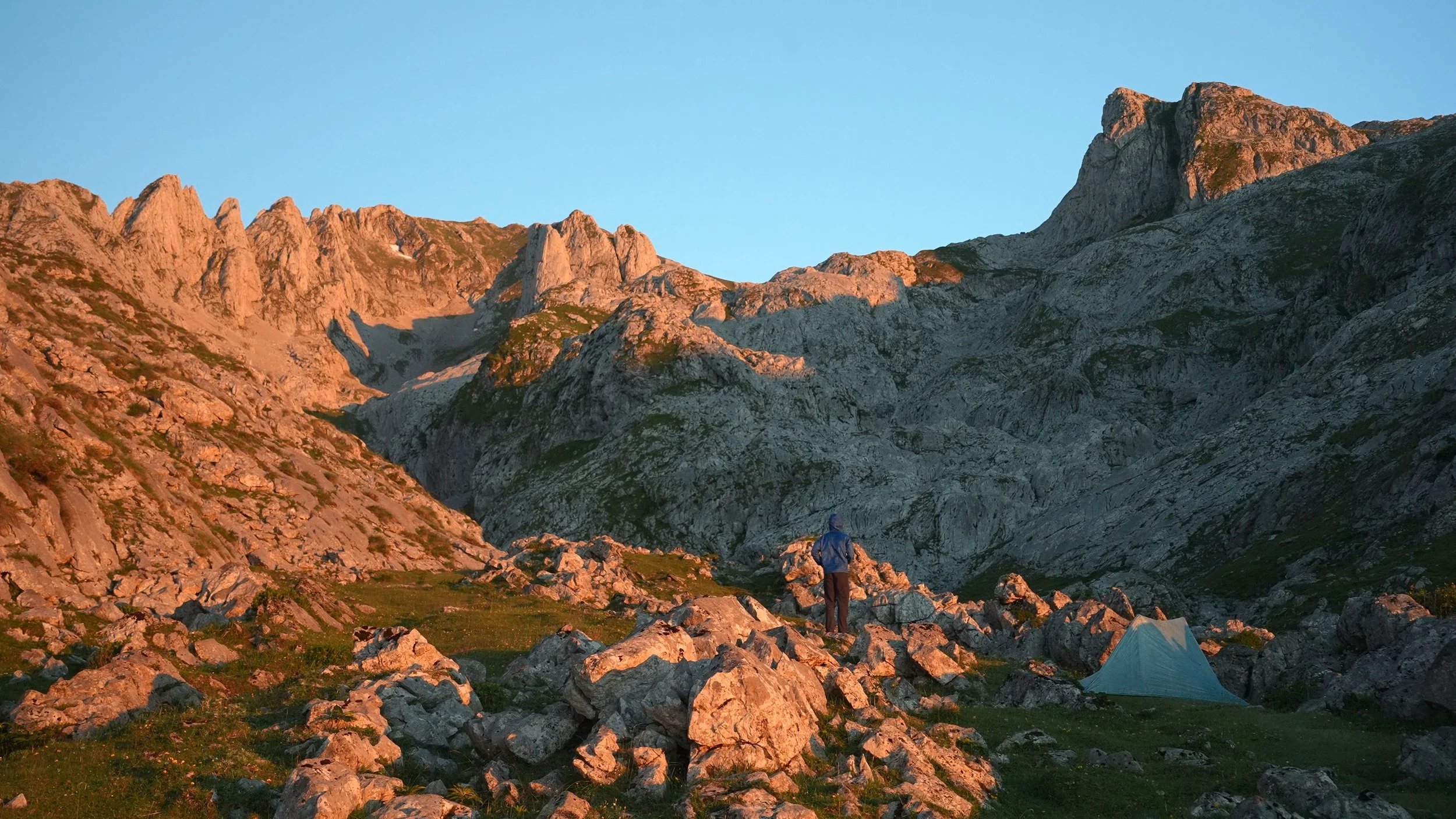
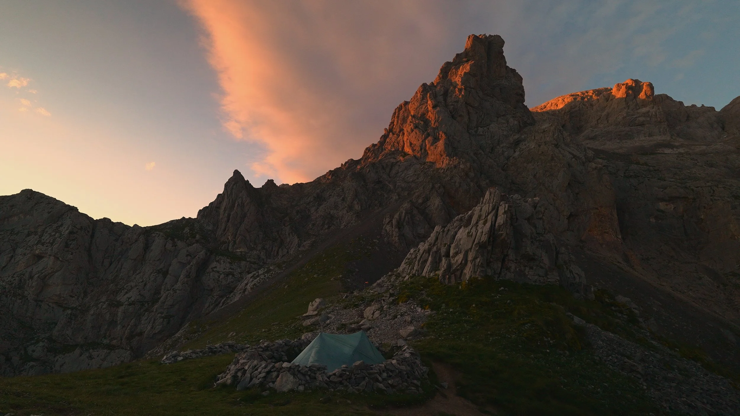
Then, almost without warning, the canyon spits you out onto a sweeping grassy plateau with views stretching nearly 360 degrees in every direction.
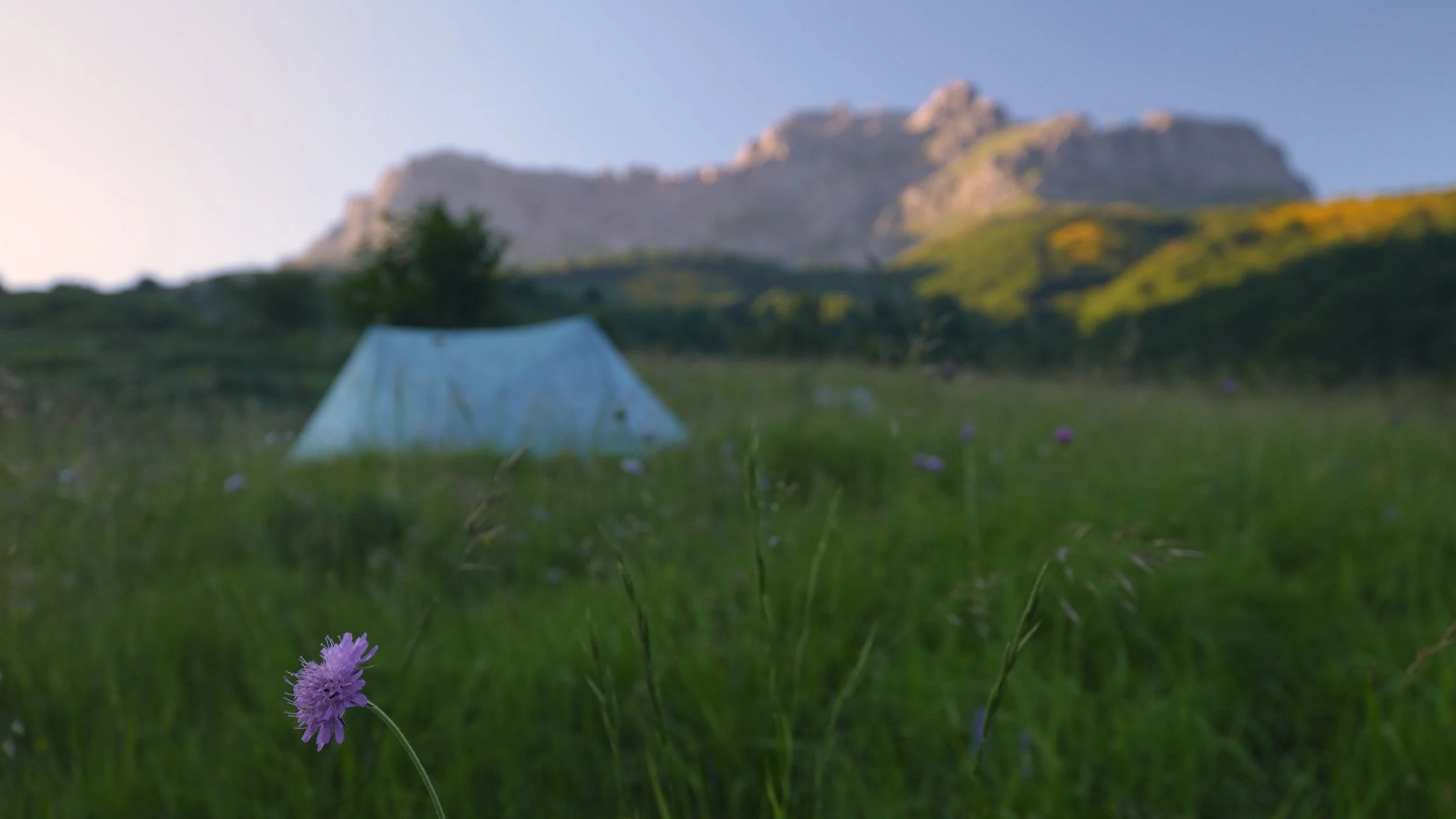
I didn't get to enjoy them immediately. No sooner had I arrived than the sky opened up, and I scrambled to pitch camp in the downpour. After thirty minutes huddled inside, the rain eased — but not before gifting me nearly a full 500ml pot of water collected straight from the sky, which I gratefully turned into tea. Water is scarce up here; there's one small stream tucked 100–200 meters below the campsite, so plan accordingly.
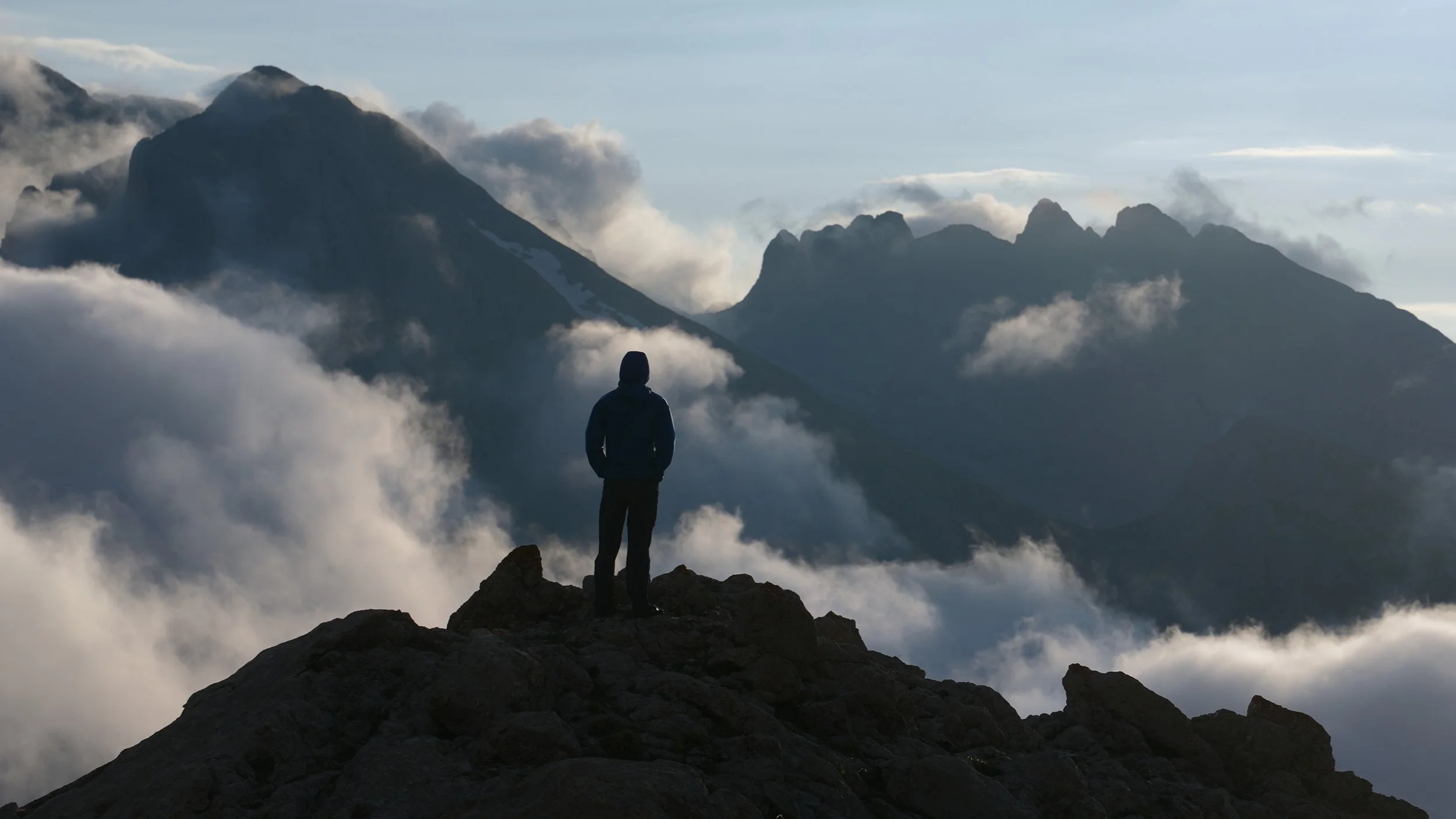
When the clouds finally cleared, the reward was everything. Mountains and valleys unfolded in every direction, golden in the evening light. I filmed, I sat, I stared. Then I went to sleep early — the happiest kind of tired.
Day Two – Goats, Dogs, and the Long Climb to Los Cabrones
Campsite: 43°12'45.43"N 4°51'24.84"W
Distance: 14 miles
Elevation gain: ~4700 feet
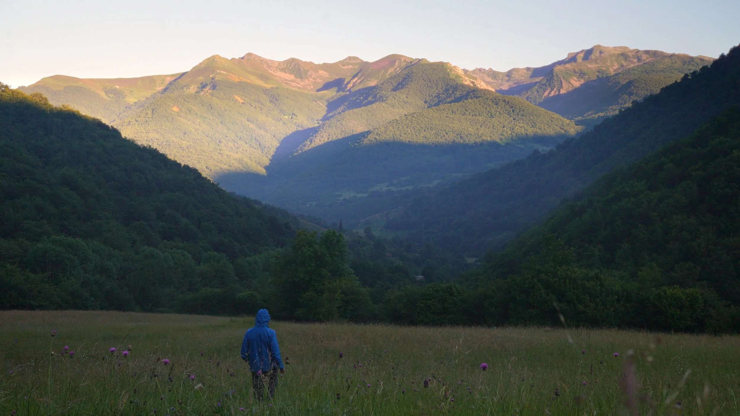
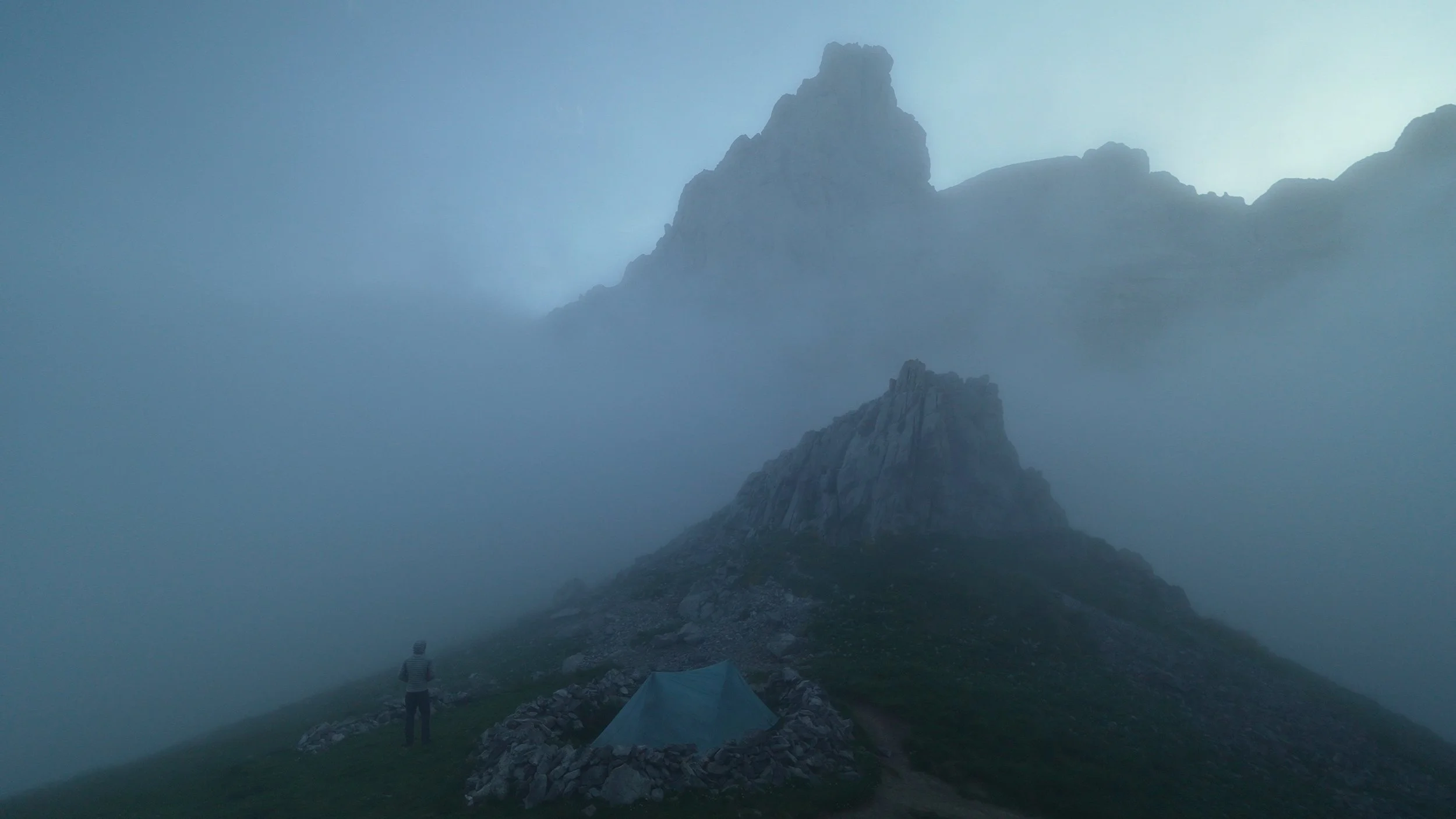
I woke up to a perfect morning. Clear skies, fresh air, the kind of start that makes the previous day's rain feel like a distant memory.
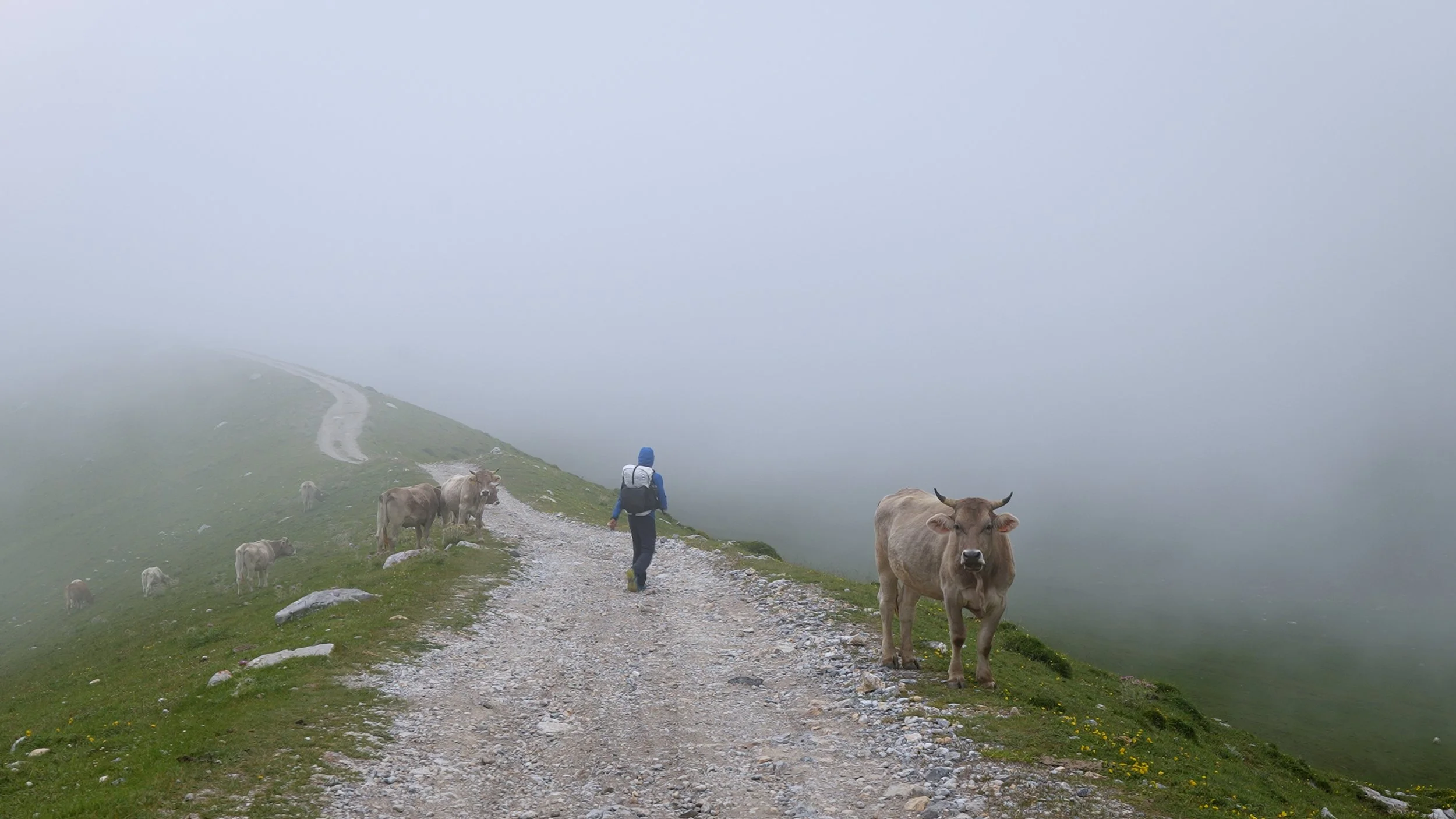
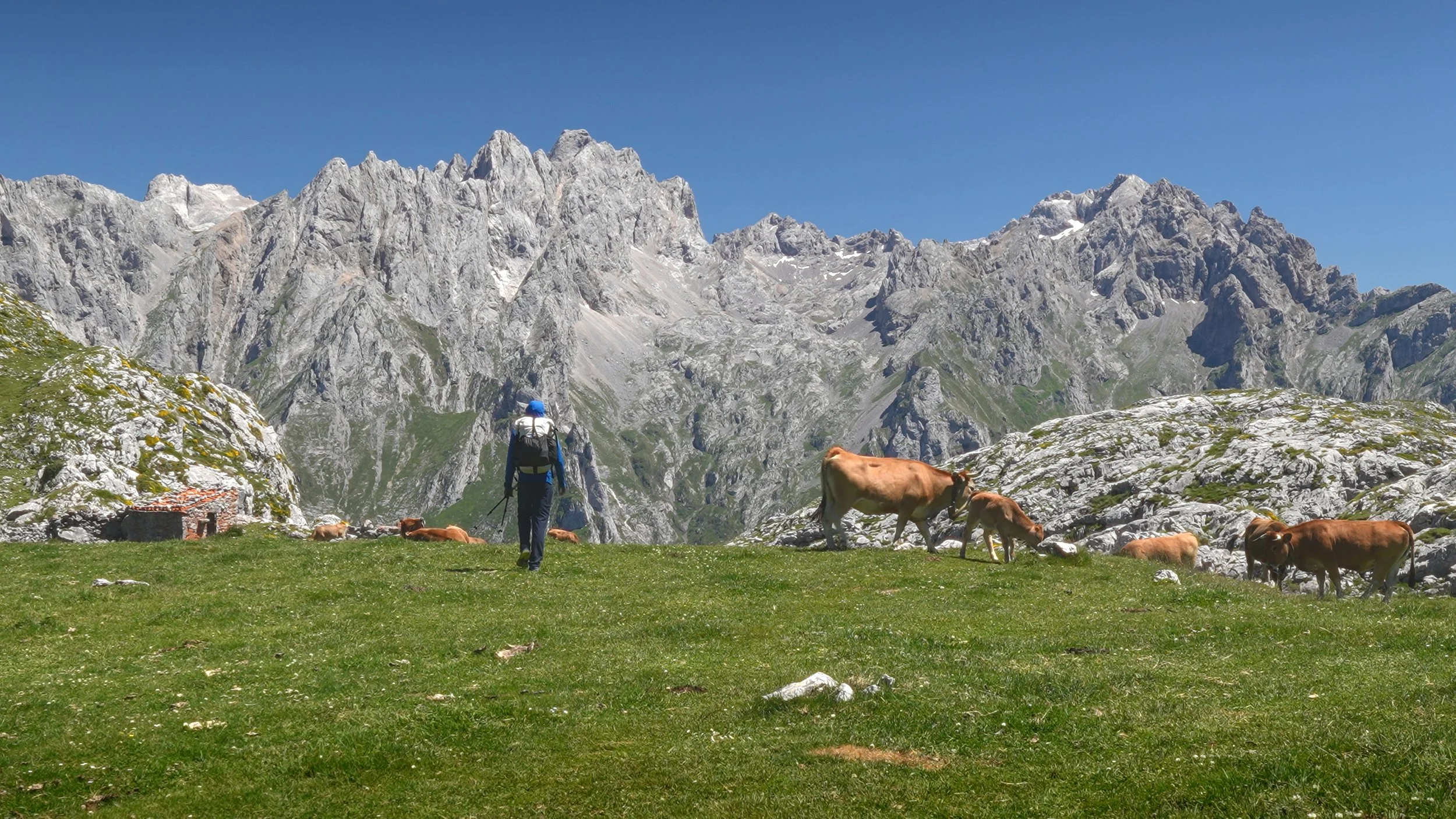
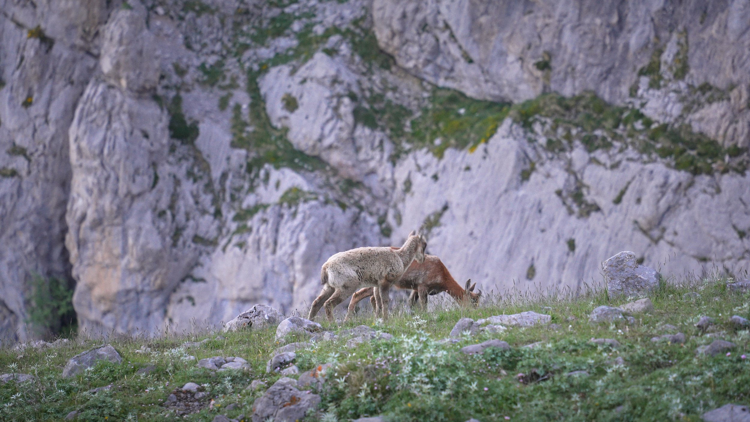
As I began breaking camp, a herd of goats materialized out of nowhere — and with them came their guardian: a massive shepherd dog. He made straight for my tent and started barking with real conviction. I stayed inside, keeping still, hoping he'd lose interest and move on. Eventually the barking stopped, and I cautiously climbed out to start packing up. The dog, apparently unconvinced, turned around and began walking toward me again, barking steadily.
I should explain my relationship with dogs. I grew up in a country where strays were common — some potentially rabid — and where domestic dogs were often kept specifically as guard animals, bred to be territorial and aggressive. Large, barking dogs don't read as friendly to me; they read as a threat. And this one was enormous. I backed away slowly, trying to create distance between myself and the herd he was protecting, but he followed, the barking growing more insistent.
Salvation came in the form of two German hikers heading the same direction. I asked for their help, and without hesitation they calmly shooed the dog away. Simple as that. I was deeply grateful.
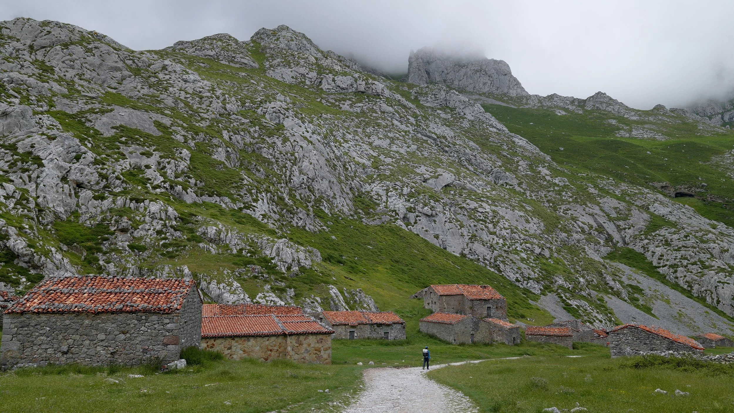
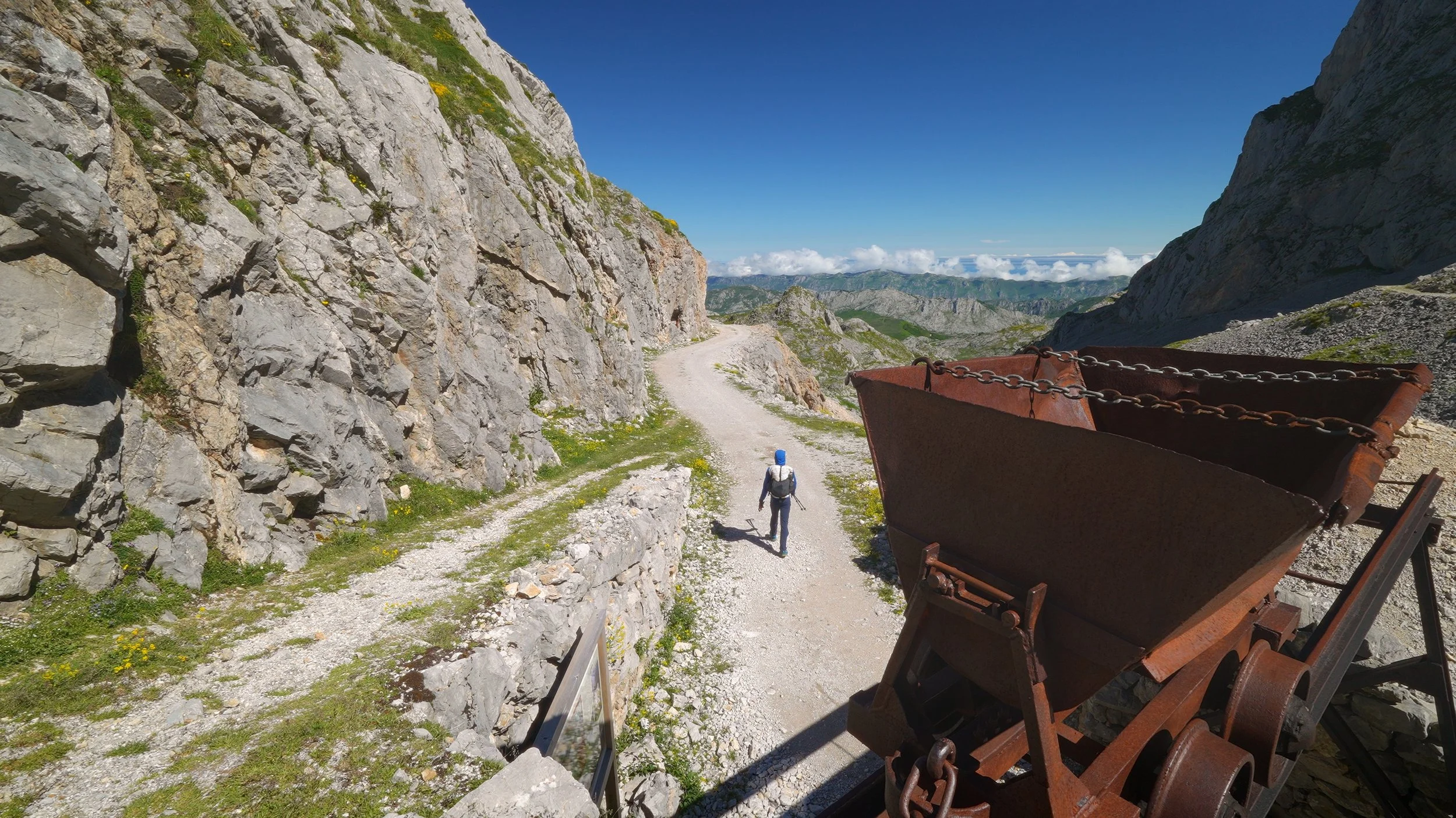
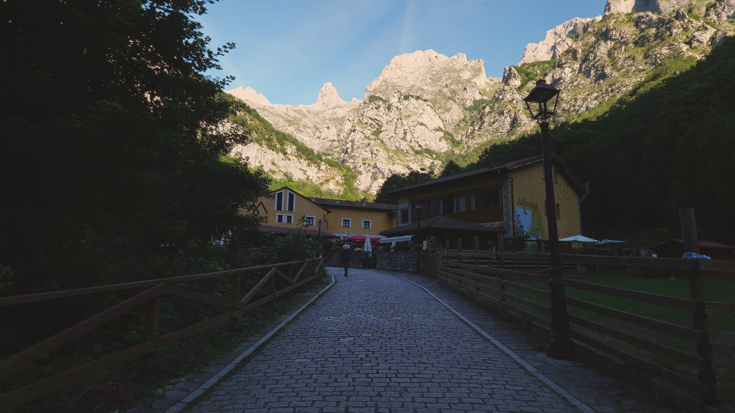
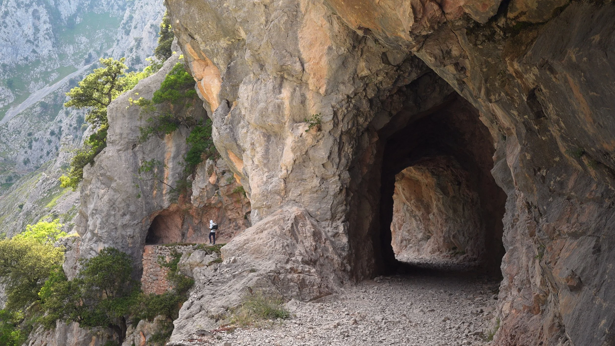
The descent that followed was a gentle, sunny affair — hot under a clear sky, but the scenery made it easy to forget any discomfort. Along the way I passed a series of old mining caves carved into the hillside before arriving at Refugio Casetón, where I stopped to rest and catch my breath.
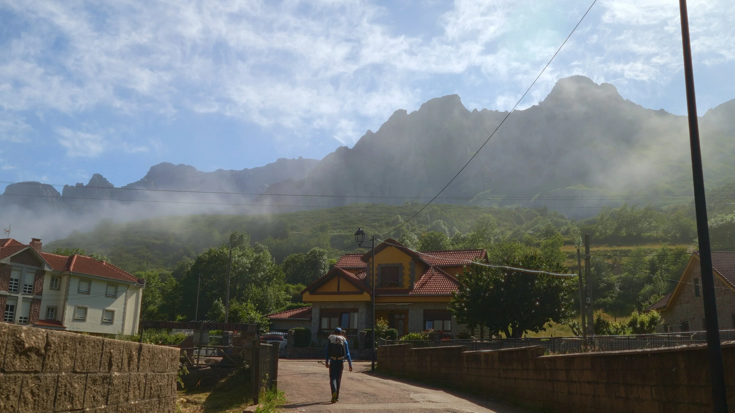
After a short break, I pressed on toward Sotres, a small mountain village with a handful of restaurants. I sat down to a very good lunch here — exactly what the body needed before the long climb ahead. And long it was. Tough going, but consistently beautiful, the kind of ascent that keeps rewarding you with views just when your legs start to complain.
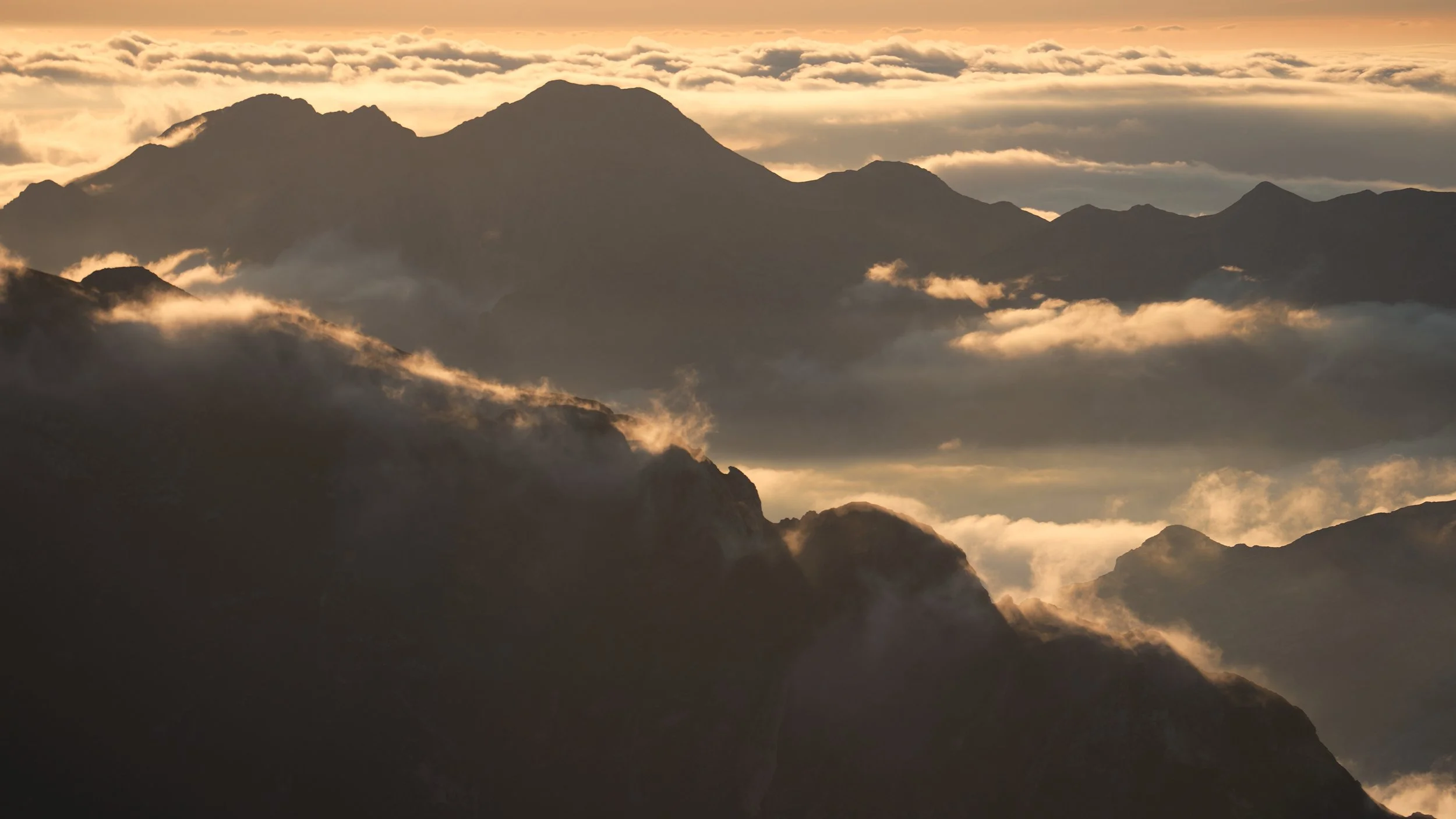
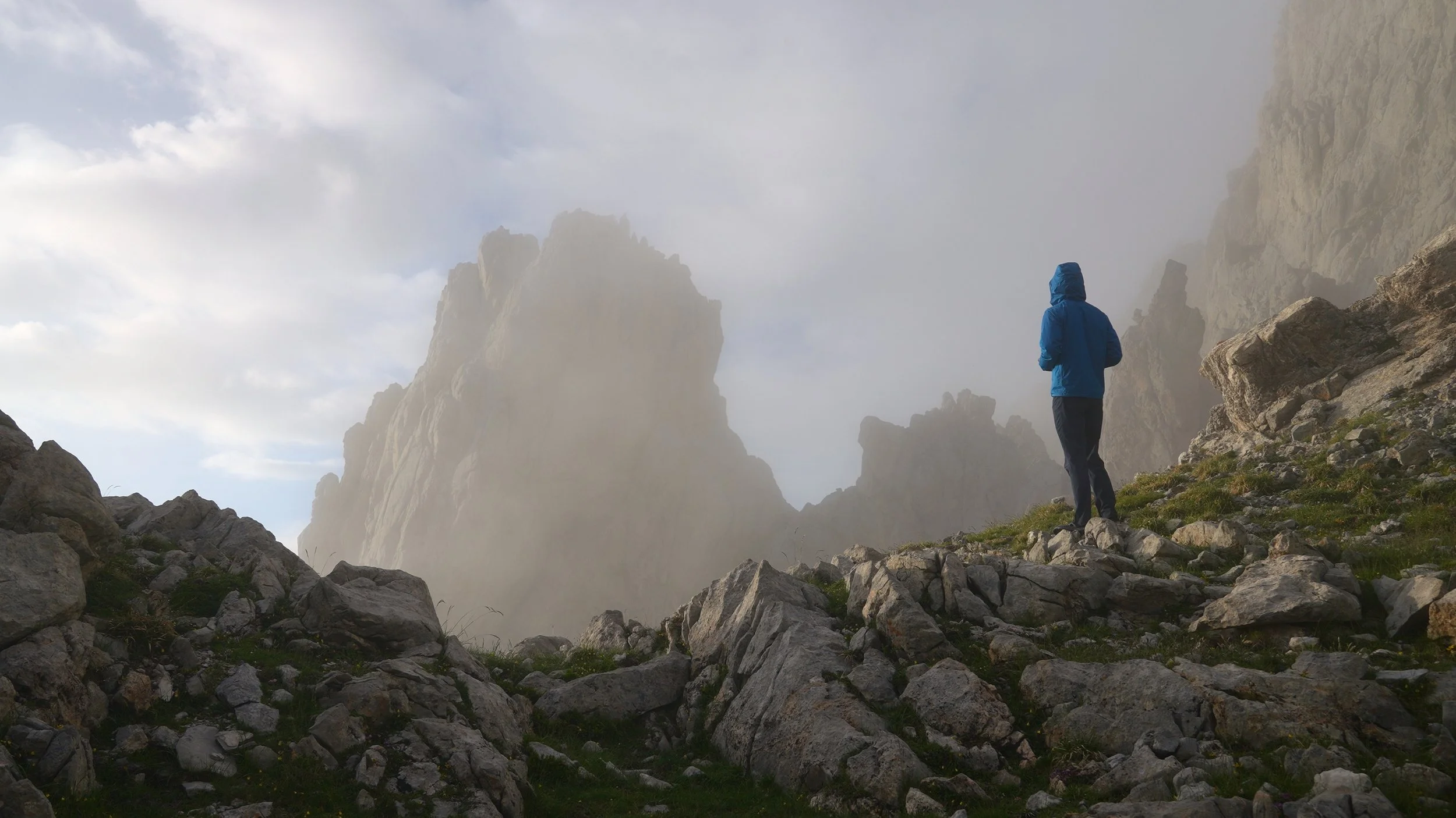
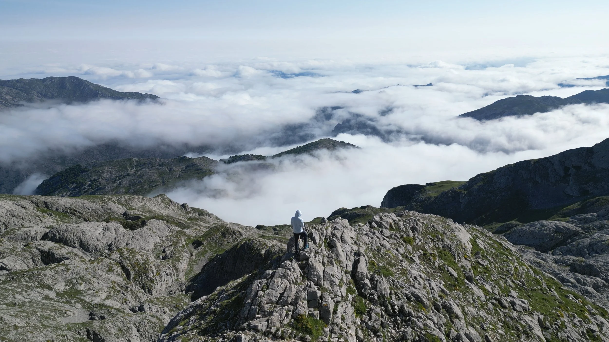
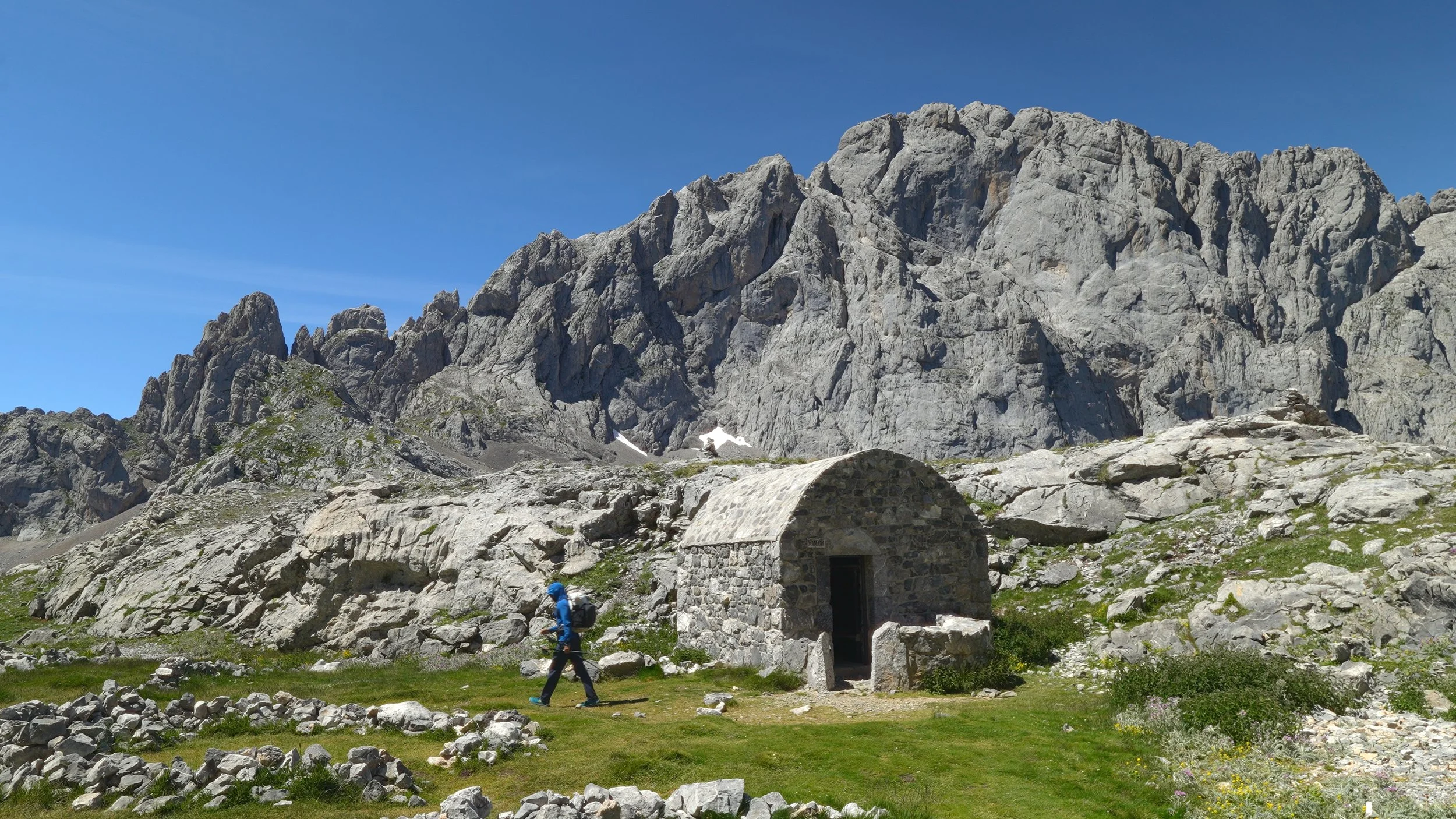
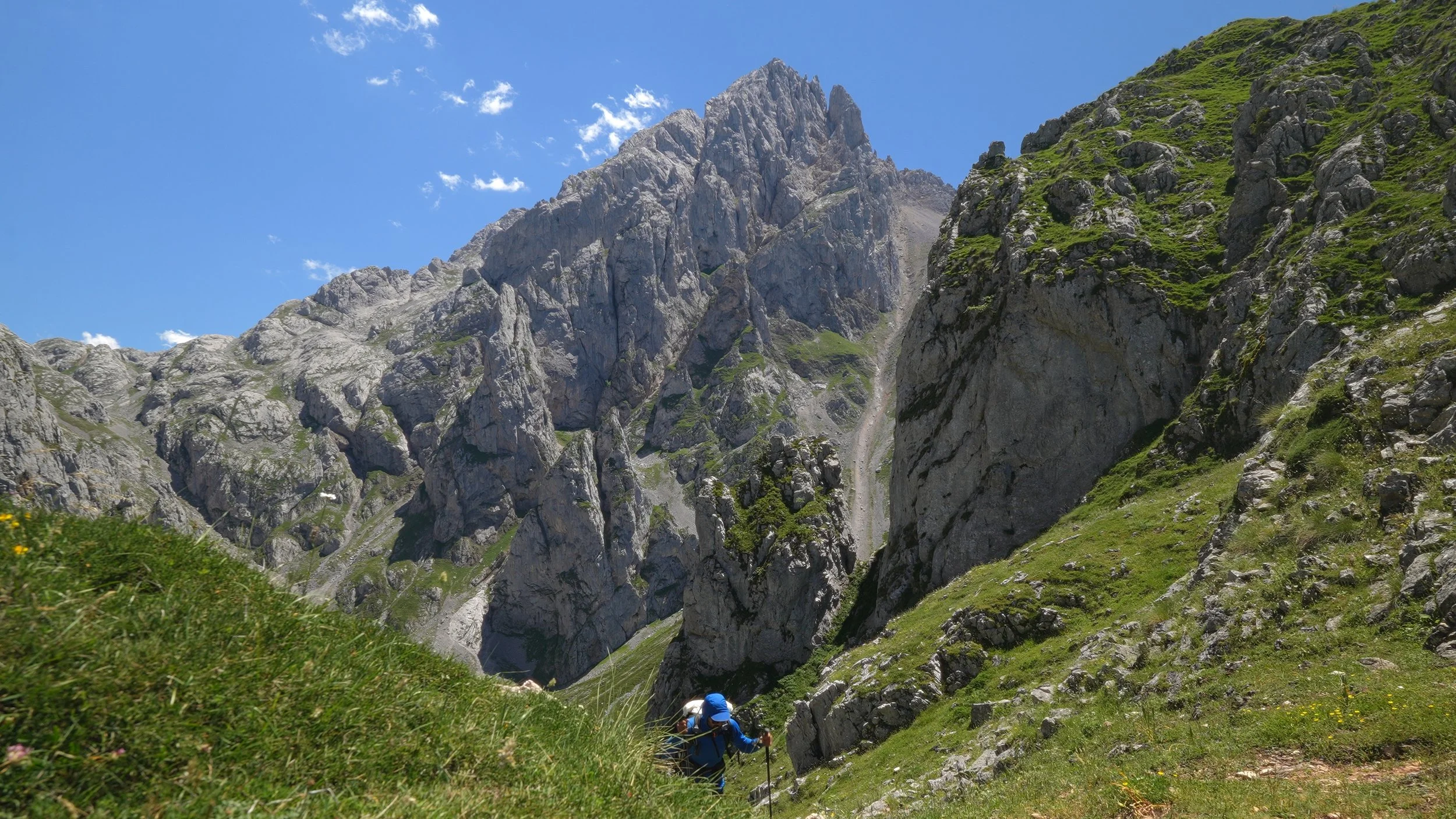
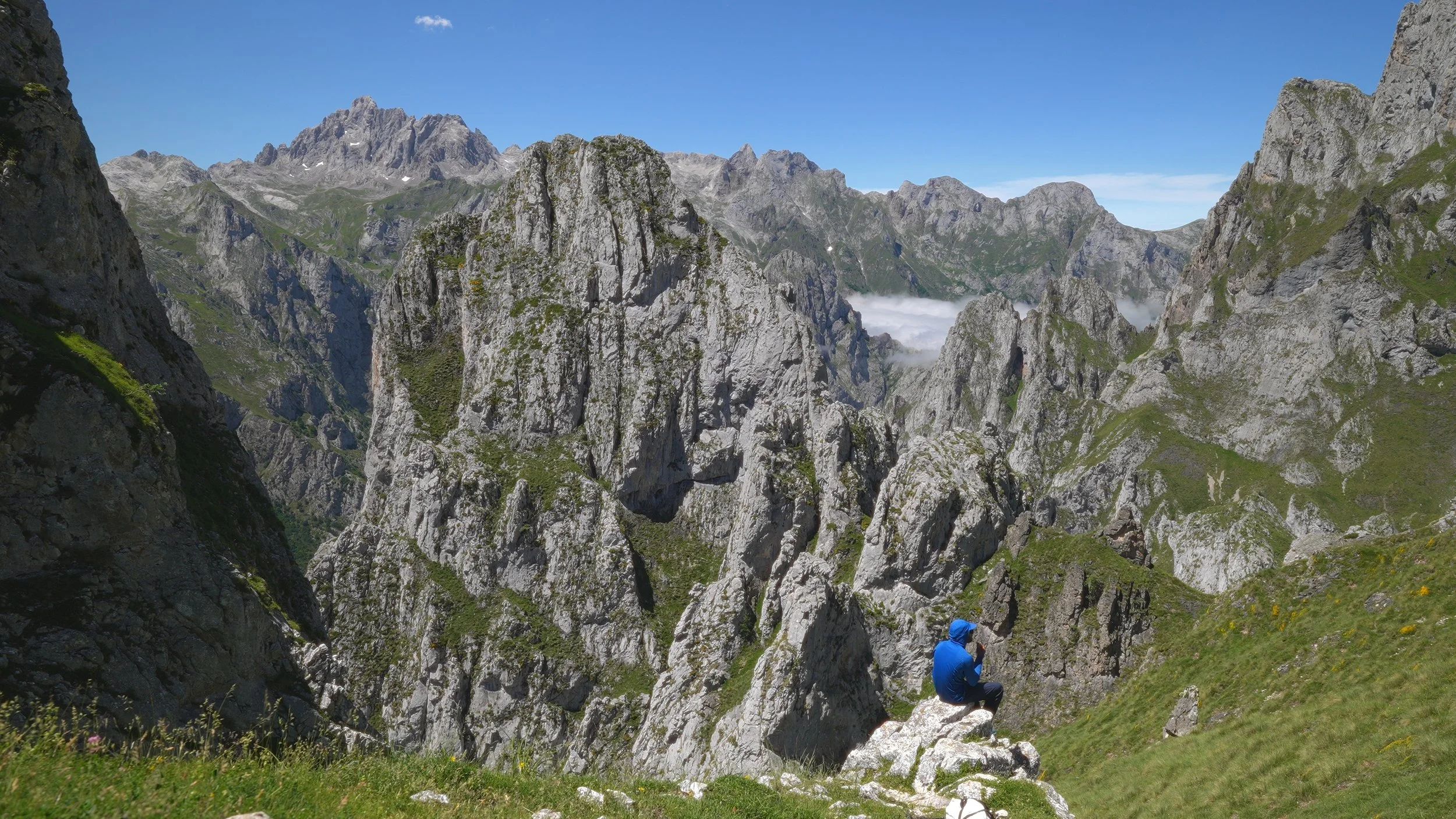
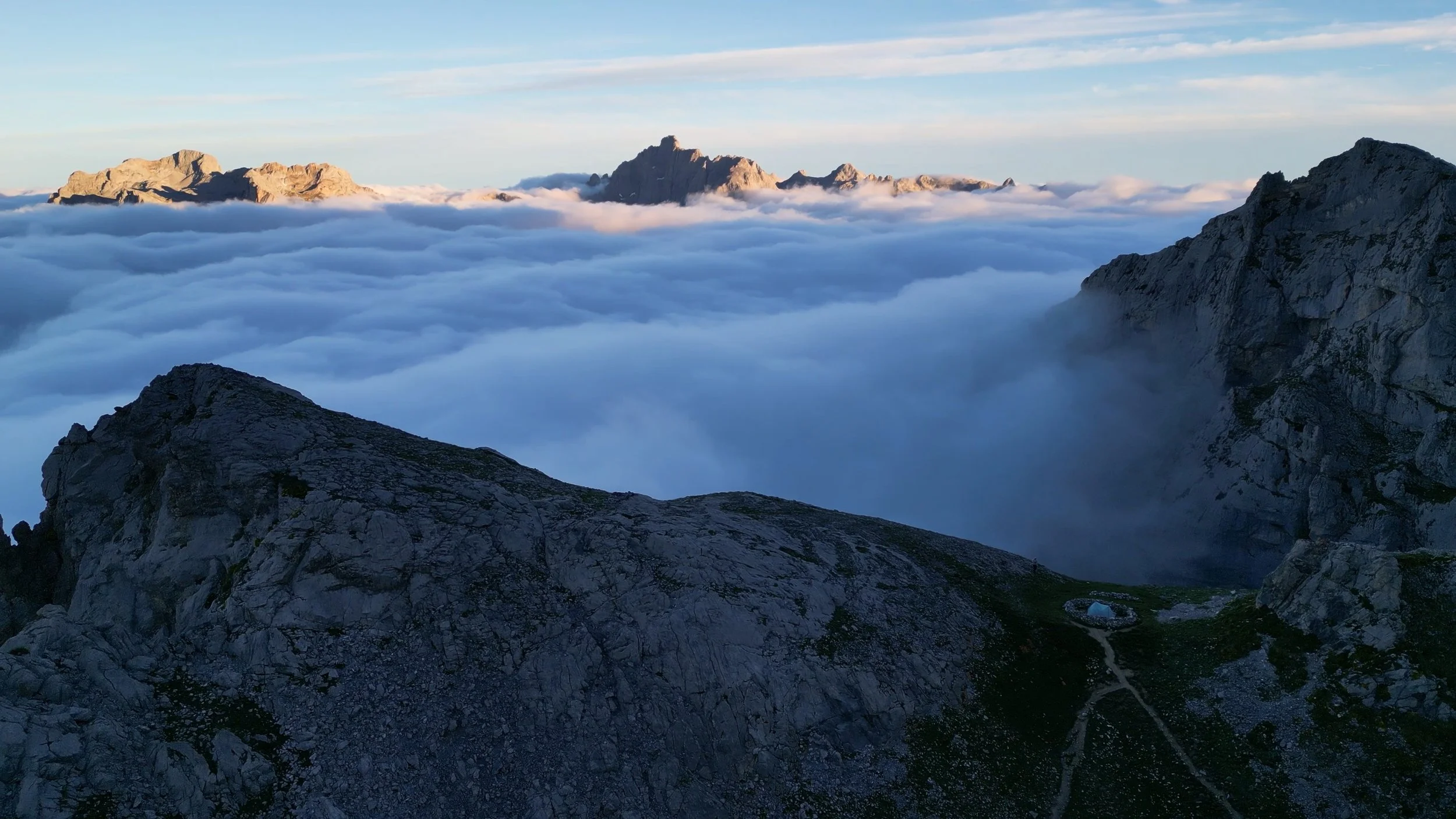
I reached Refugio Vega de Urriellu earlier than expected, but low fog had rolled in and flattened the scenery into shades of grey — not quite the setting I wanted to wake up to. So I pushed on. The stretch between the two refugios is not for the faint-hearted: exposed ridgeline, metal rungs bolted into rock faces, and a trail that demands your attention. But the drama of the landscape more than earns the effort.
I made camp at Refugio de Los Cabrones, ringed by striking peaks on all sides — a genuinely beautiful spot. It was also packed. Clearly, I wasn't the only one who'd decided it was worth the extra miles.
Day Three – Peaks, Pastures, and the Cares Gorge
Campsite: 43°12'46.41"N 4°54'12.95"W
Distance: 12.5 miles
Elevation gain: ~1500 feet
The day opened beautifully and never really let up.
The morning began with a rocky technical section that kept the mind sharp and the feet busy. That gave way to something entirely different — a sweeping grassy hillside dotted with cows, unhurried and unbothered, the kind of pastoral scene that makes you slow your pace without realizing it. Then came a steep, knee-testing descent before the trail flattened out and funneled into the main event: the Cares Gorge.
The gorge is spectacular — a narrow path carved into sheer cliff faces above a turquoise river, stretching for several miles with barely a dull moment. Its reputation is well earned, and so is its popularity. On weekends especially, expect company. Plenty of it.
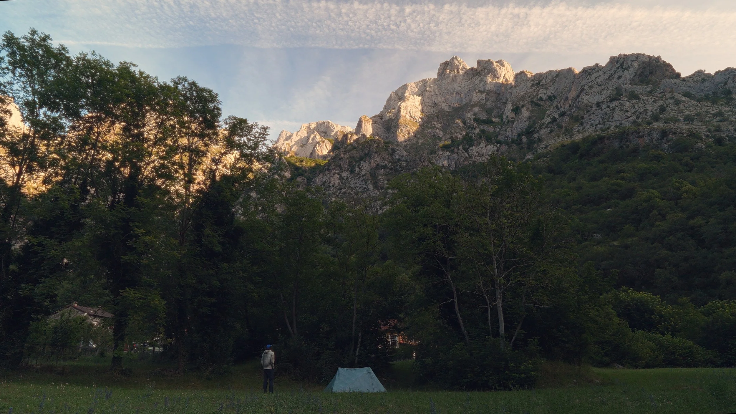
The trail ends at Caín, a small, quietly charming village with a handful of restaurants and hotels tucked between the mountains. I settled into a restaurant, plugged in my camera batteries to charge, ordered food, and watched a UEFA Euros quarterfinal between Turkey and the Netherlands play in the same restaurant — an unexpectedly civilized end to a big day in the hills.
For those planning to stay the night, there's a small market where you can stock up on supplies — instant noodles included, for the campers among us. Speaking of which, there is a modest flat area suitable for tents, though you'll likely have neighbors of the four-wheeled variety: car campers tend to settle in close by. Its still very quite.
Day Four – The Hard Way and the Long Haul to Vegarredonda
Campsite: 43°13'56.73"N 4°59'29.77"W
Distance: 13 miles
Elevation gain: ~3900 feet
Out of Caín, there are two ways to reach the next campsite. You can either navigate the trail that climbs directly from the edge of town, or backtrack nearly three miles along yesterday's route to pick up a cleaner path. I chose the town trail and paid for it.
Calling it a trail is generous. I had AllTrails open almost continuously, second-guessing every junction, losing the line, finding it again, losing it once more. The time it cost me would have been more than recovered had I simply swallowed my pride and retraced my steps. If you're faced with the same choice: backtrack. You'll thank yourself later.
Once you find your footing — literally and figuratively — fill up at the creek you'll cross on the way up. Don't skip it. The trail climbs steeply before eventually leveling off and continuing toward Refugio Vega de Airo, where I spotted a few tents pitched nearby. It was too early in the day for me to stop, so I pressed on.
There are several small water sources between Vega de Airo and the next campsite — worth topping up when you can, even if you feel you don't need to yet.
Beyond this point the trail becomes increasingly difficult to follow, and this is where the day started to grind. The terrain turned rocky and uneven underfoot, demanding constant attention with every step. Route-finding on top of rough ground is a particular kind of exhausting — not just physical, but mental. The miles felt longer than they were. Progress felt slower than it should have been.
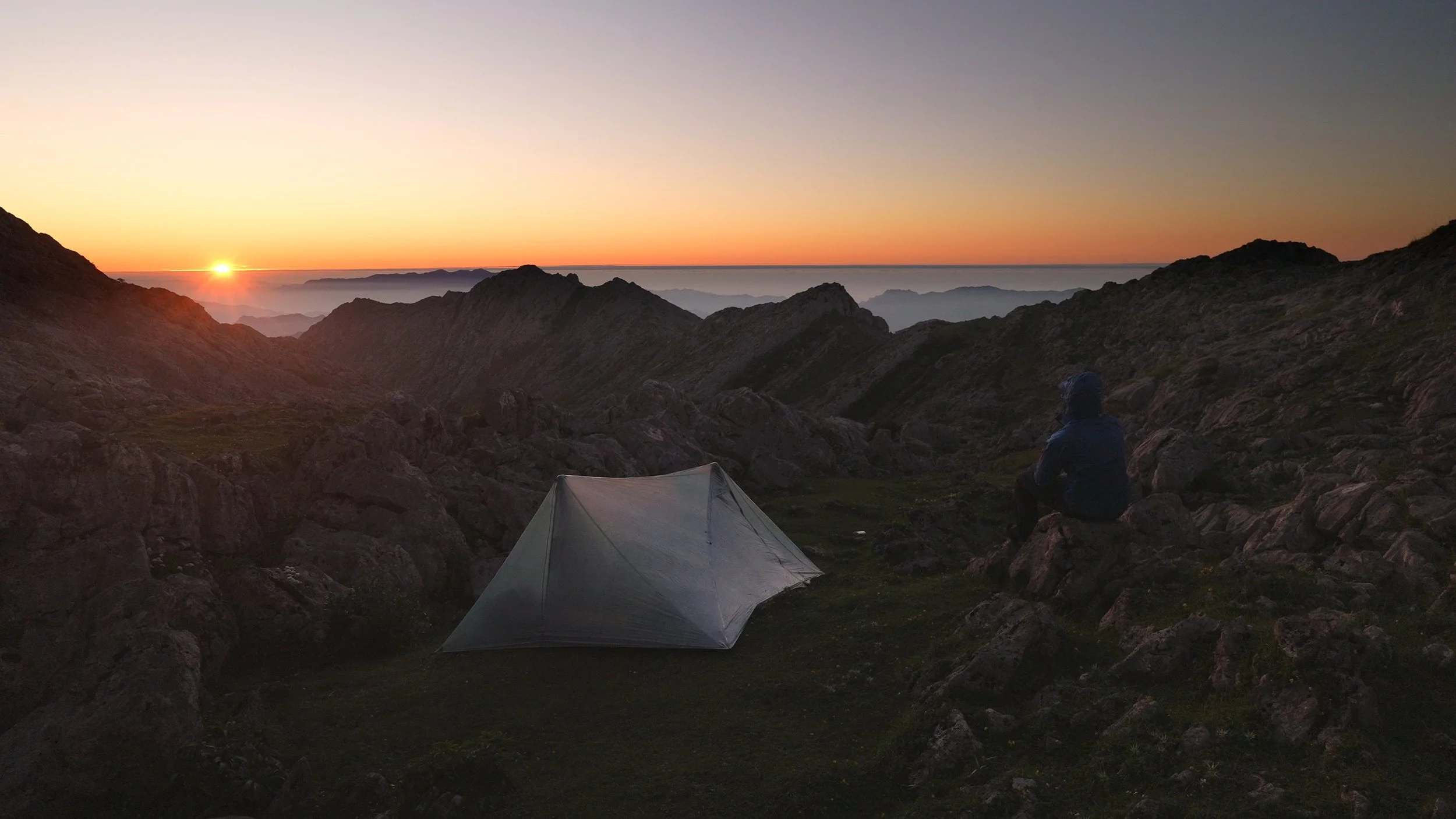
It took far longer than expected before Refugio Vegarredonda finally came into view. I pushed past the refugio itself and found a spot further up the hill, close to the trail and within earshot of running water — a small but meaningful luxury after a day like that.
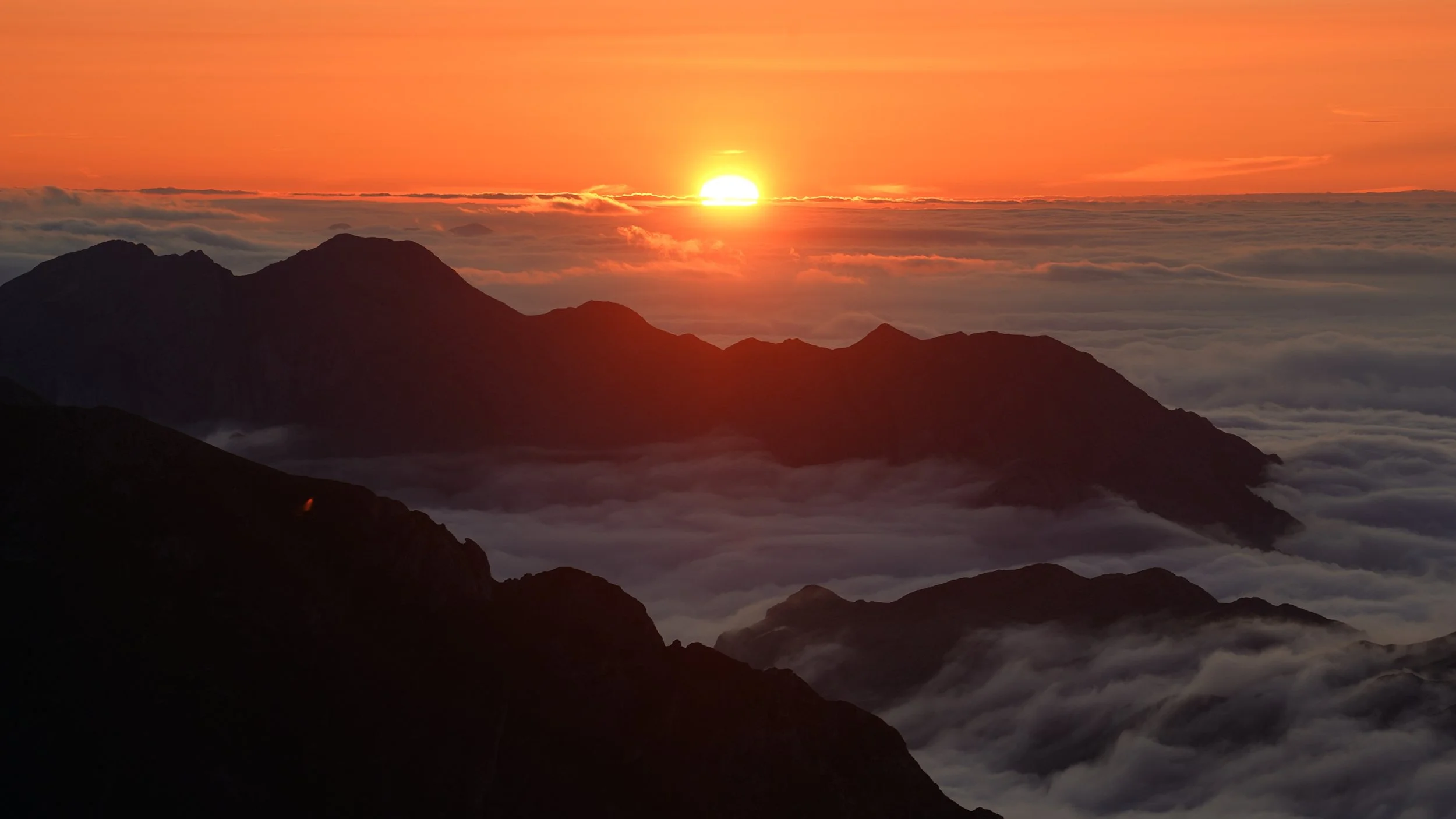
Long, hard, and at times demoralising — but never anything less than beautiful. The scenery refused to disappoint even when everything else did. I caught the last of the sunset, then went to bed early, already asleep before dark had fully settled in.
Day Five – Stone Shelters, Forest Paths, and the Road to Vegabaño
Campsite: 43°08'59.23"N 4°57'36.79"W
Distance: 14.5 miles
Elevation gain: ~3500 feet
Another long, demanding day — the mountains here don't offer many easy ones.
It began with a climb of several hundred meters, legs still heavy from the day before, before settling into a lengthy stretch of loose, poorly marked trail that required the usual combination of patience and phone navigation. The kind of hiking that is more mentally wearing than physically — you're never quite sure you're where you should be.
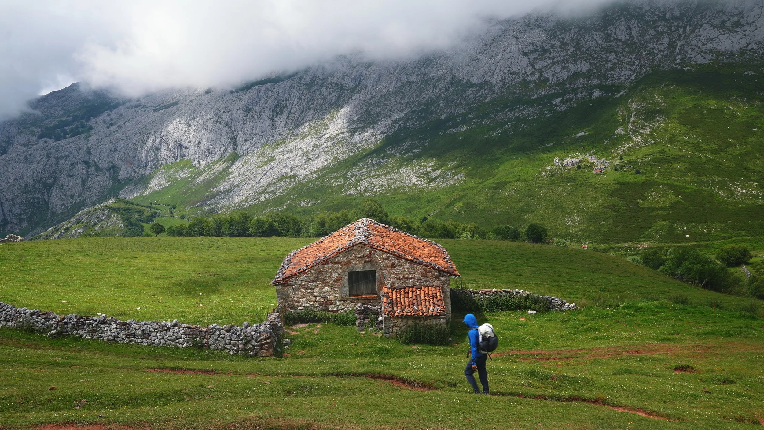
Along the way you'll pass Cabaña Vega Huerta, a small stone shelter sitting quietly in the landscape. Inside there's a basic bunk bed, and running water can be found close by. There are no amenities and no fee — it's as simple and honest as mountain accommodation gets. Worth considering as a night stop if the day has taken it out of you.
A word of caution though: the following morning I crossed paths with two Czech hikers who had sheltered there the night before. Late in the afternoon, two shepherd dogs had descended on the area and refused to leave, trapping them inside for hours. They missed the sunset entirely, waiting it out until the dogs eventually moved on. If you're camping or sleeping in exposed spots in this region, the shepherd dogs are a recurring and unpredictable presence — as I had already discovered myself.
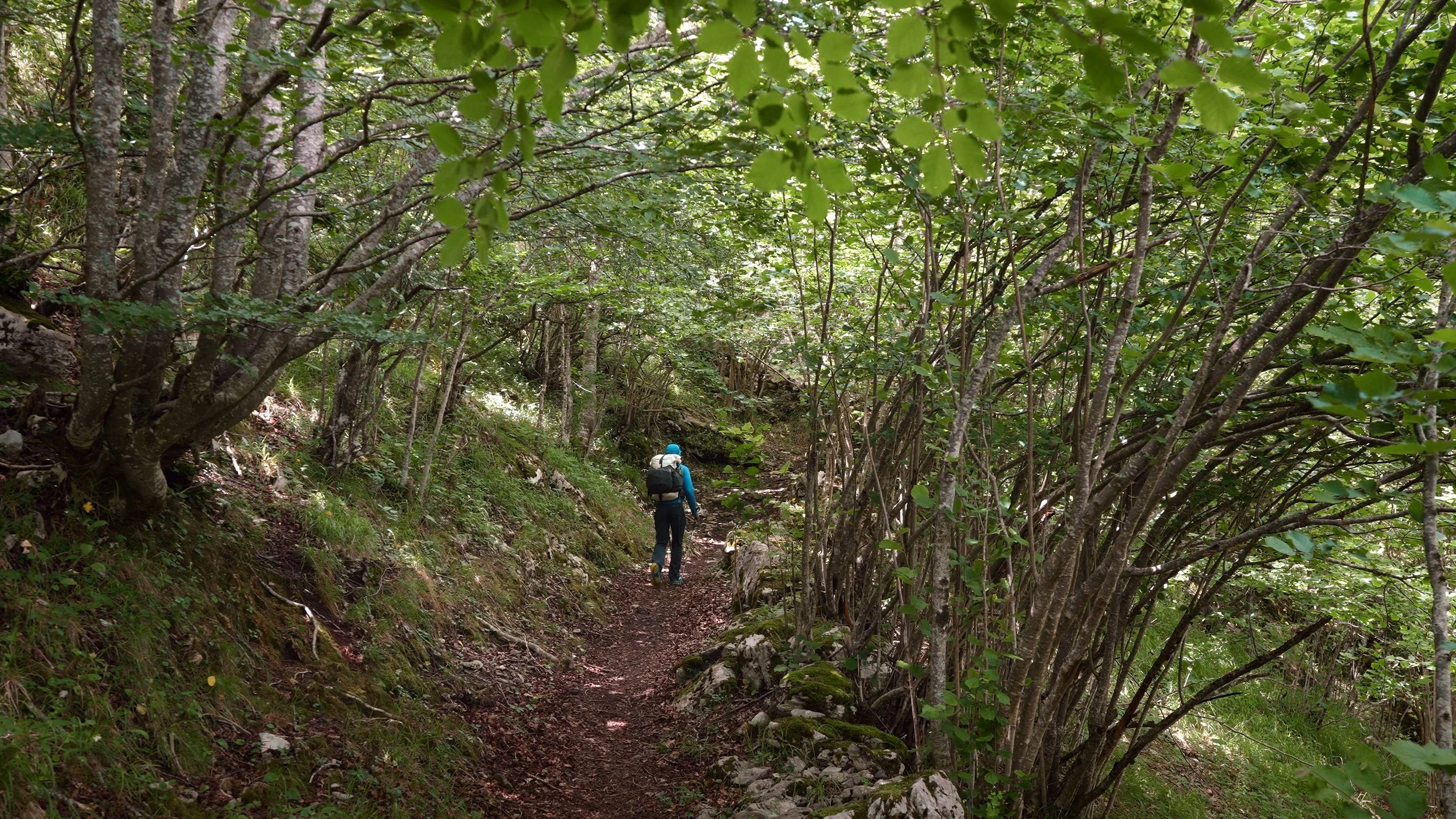
From Cabaña Vega Huerta the tone of the day shifts considerably. The trail eases and passes through a stretch of genuinely beautiful forest before arriving at Refugio de Vegabaño — a welcome and peaceful end to a tough stretch of days. If you prefer a roof and a bed, the nearby town of Posada de Valdeón is worth the small detour: a lovely village with proper lodging, a few shops, and restaurants where you can sit down to something warm and well-earned.
Day Six – The Long Climb to Jermosa
Campsite: 43°10'23.60"N 4°52'13.16"W
Distance: 8.1 miles
Elevation gain: ~4650 feet
A long day, and one of the most rewarding of the entire route.
The morning takes you through the town of Posada de Valdeón — a good last opportunity to fill water bottles, top up supplies, and prepare yourself mentally for what comes next. Do not skip the water stop. The climb ahead is nearly 4,000 feet and dry the whole way up — no streams, no reliable sources — so leave town fully loaded.
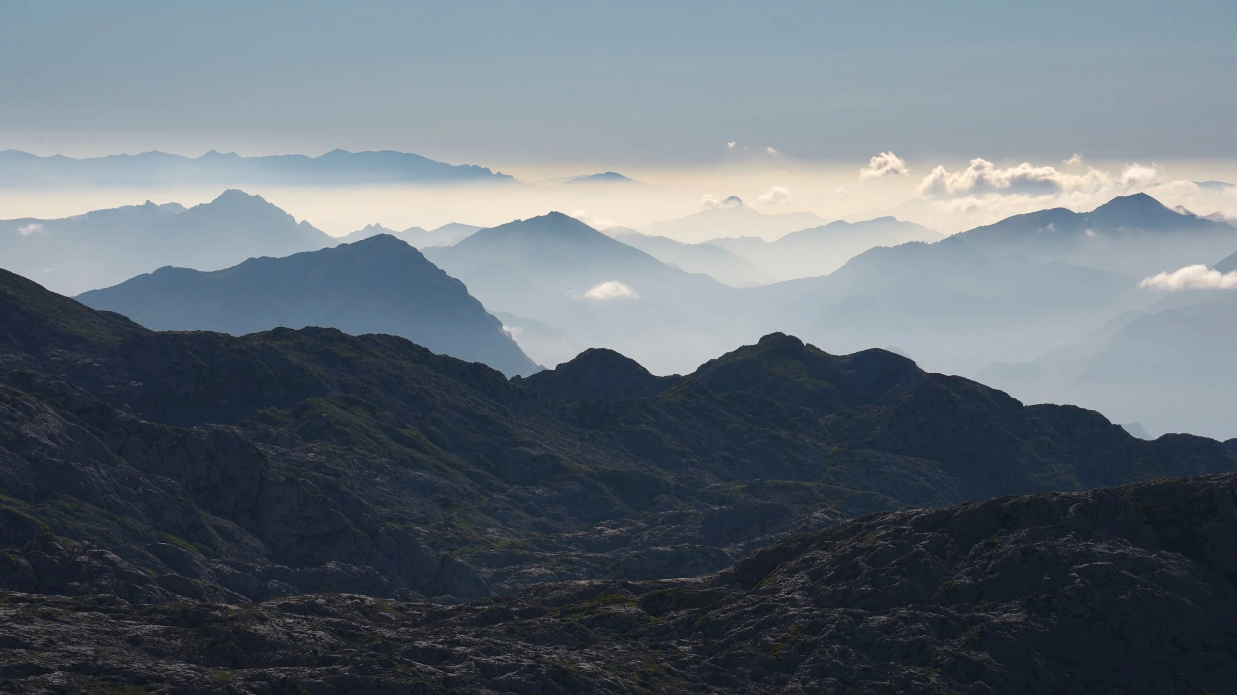
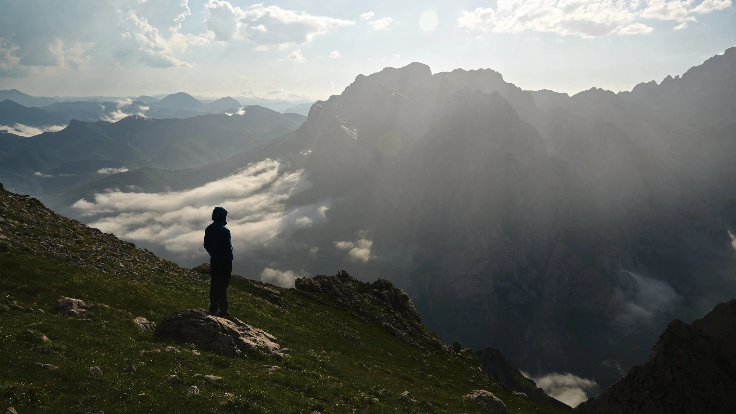
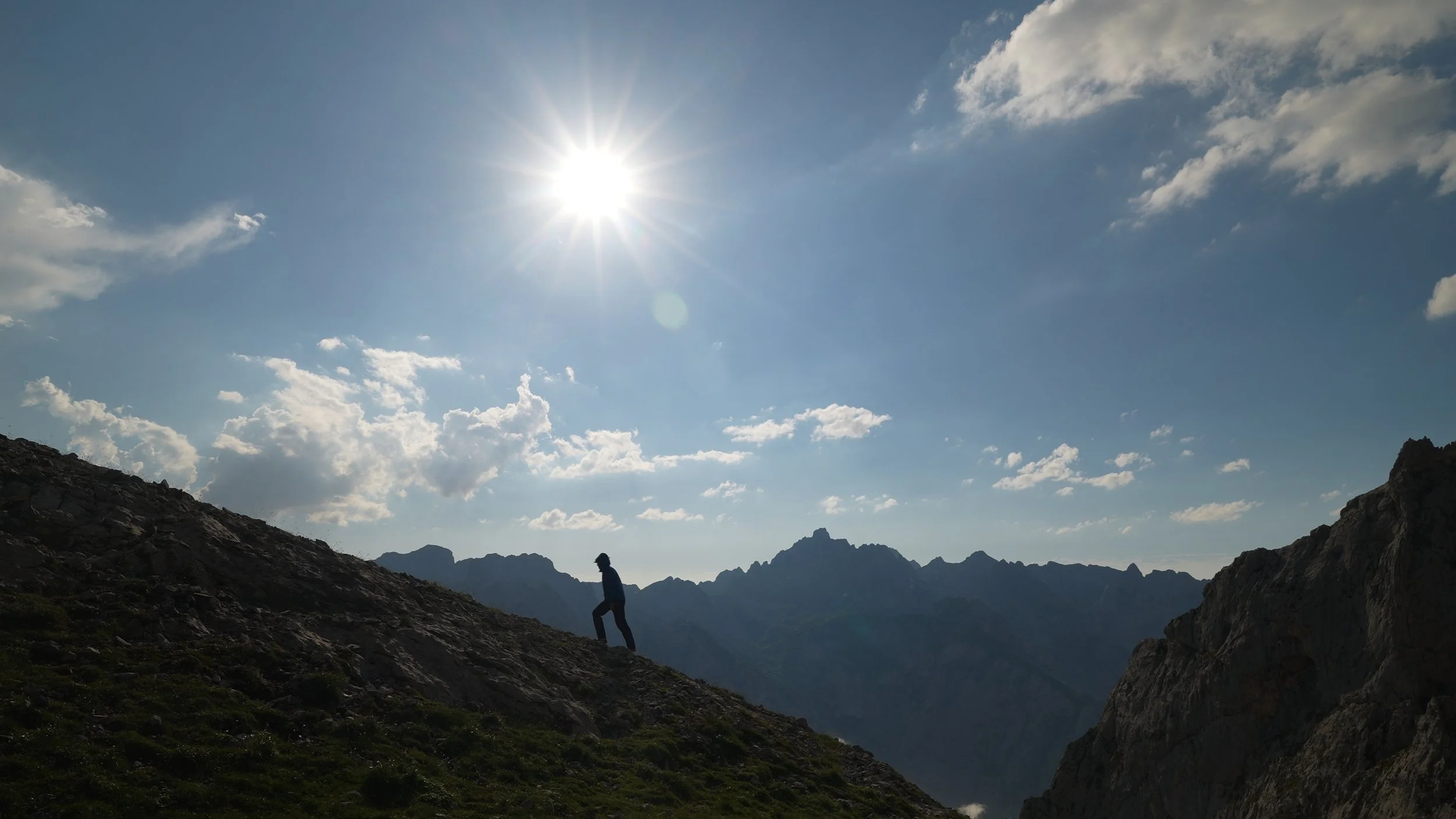
The ascent begins in forest, cool and shaded, before the trees thin out and the mountains open up around you in all their scale and indifference. It's the kind of landscape that makes you feel small in the best possible way. The trail climbs steadily, reliably, and — it must be said — seemingly without end. Just when the top feels close, another switchback reveals another stretch of mountain above you.
The final approach to Refugio Jermosa is the most demanding section: loose gravel on a steep pitch where hands and feet both earn their keep. You'll be on all fours, picking your way carefully upward, the summit tantalizingly close. Take your time here. The footing is unreliable and the exposure unforgiving.
Then you're up. There are several flat camping spots near the refugio, but the one at the very top earns its place — wide, open, and commanding views in almost every direction. If your legs have anything left in them, it's worth pushing for.
The refugio itself sells drinks and sandwiches, and running water is available nearby — small comforts that feel enormous after a climb like that. Sit down, eat something, and let the mountains do the rest.
Day Seven – Rain, Rock, and the Long Way Down to Fuente De
Distance: 6.3 miles
Elevation gain: ~1800 feet
Every long trip in the mountains eventually offers up a bad weather day. This was mine.
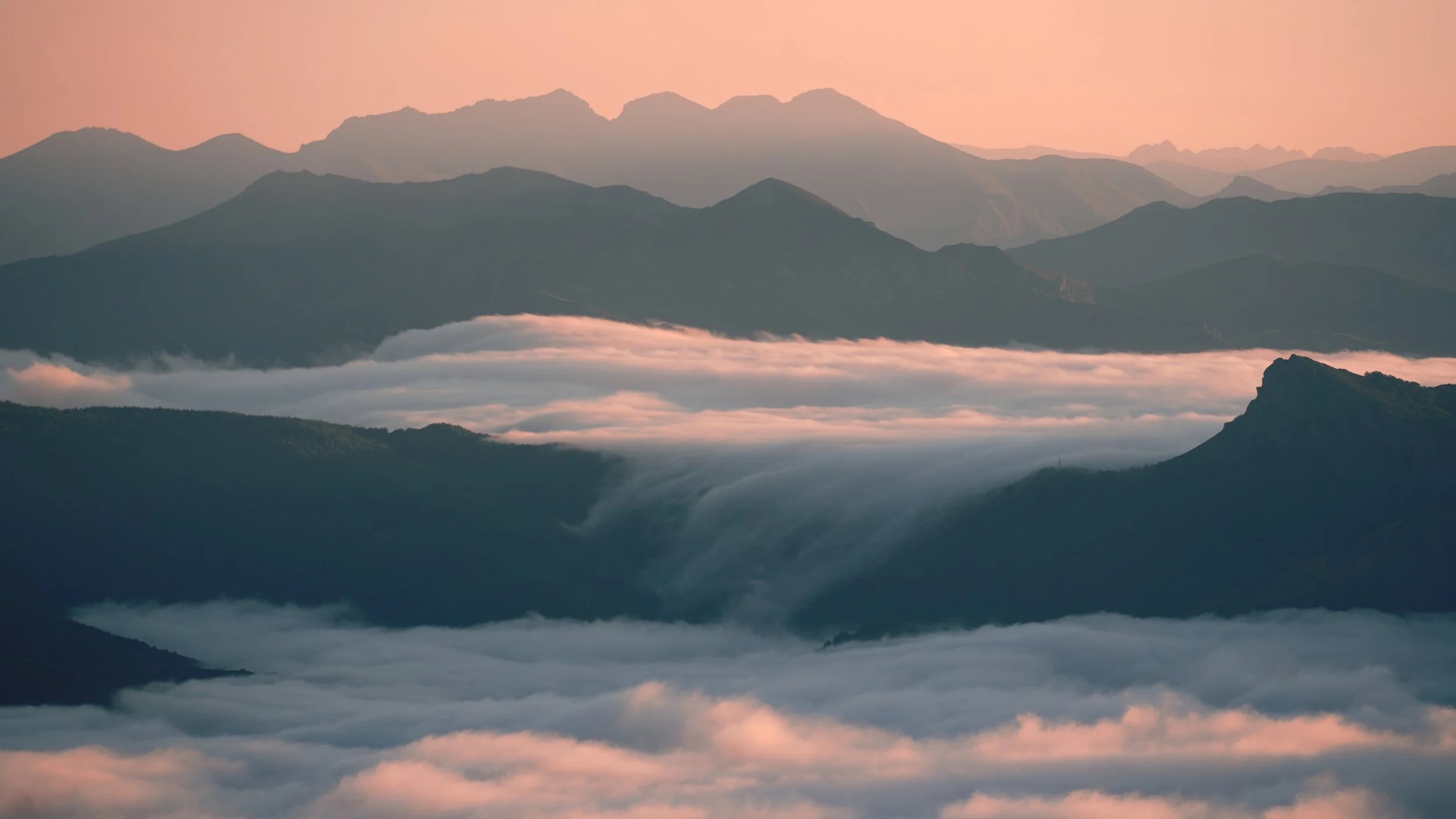
It started well enough — clear skies, the familiar rhythm of boots on trail. Then the clouds rolled in, thickened, and lowered until the world shrank to a grey radius of twenty meters in every direction. The rain followed. What had been an exposed, dramatic ridgeline became a slick, featureless puzzle of wet rock with almost no visible trace of a path. AllTrails stayed open on my phone for the better part of the day — less a convenience than a lifeline.
Somewhere in the murk I came across a man and his dog, both looking uncertain. He had lost the route and couldn't find his way back. We fell in together without much discussion — there's an unspoken logic to company on a day like that — and the three of us picked our way down together until the trail finally relented and the way forward became clear again.
On the descent you'll pass Cabaña Verónica, an oddly shaped structure that looks like it was designed by someone working from memory of what a building should look like. It has a certain charm for all that. We stopped for drinks — very welcome ones — and took a moment to dry out slightly before pushing on. There are a small number of camping spots clustered nearby if you need to call it a day here.
Beyond Cabaña Verónica the trail softens considerably, the rock giving way to easier ground as the cable car station at Fuente De draws closer. After the day's grinding, disorienting descent, the sight of it felt like a small but genuine triumph.
Total Distance: 80-90 miles
Difficulty: The trail involves significant elevation gain, but the rocky terrain and occasionally hard-to-follow path make it even more challenging. Bringing a map on your phone is essential for navigation.
Getting to the Trailhead
Several options are available depending on your schedule and budget.
By car (recommended): I flew into Bilbao and rented a car, driving directly to Fuente Dé. With only a few days to spare, this was the most time-efficient option — no transfers, no waiting, and full flexibility once I arrived.
By bus: If you'd prefer public transport, take the airport bus from Bilbao to the Intermodal Station, then catch a connecting bus to Santander. From Santander, a further bus will take you to Fuente Dé. It's a longer journey with a few transfers, but perfectly doable.
Where to stay: Fuente Dé has both camping and hotel options. A convenient base is Camping El Redondo Picos Europa (campingfuentede.com), a campground right in the area close to the cablecar.
Food: You don't need to carry much food, as restaurants and refugios are available along the way. That said, I did rely on a freeze-dried meal on the first night. If you feel you would need a gas canister it would be better to get from Bilbao or any other major city.
Water: Water sources are plentiful enough throughout the section that, with a little planning, running out shouldn't be a concern.
Download the .kml file here for navigation with all the locations of my campsites and water sources. Use on maps.me or other apps.